Introduction
Buckinghamshire is an inland county of southern England, having borders with Middlesex to the SE, Bedfordshire and Hertfordshire to the E, Northamptonshire to the NW; Oxfordshire to the W and Berkshire to the SW. It is slender and irregular in shape; much longer from N to S (53 miles) than from E to W (average width 18 miles). Its area is 477,151 acres, which places it 32nd of the 39 counties in size.
Landscape, Geology and Building Stones
Buckinghamshire falls into four broad landscape zones, arranged in parallel strips crossing the county from SW to NE and characterised by the underlying geology. The river Thames marks the southern border of the county, and its floodplain and those of its tributaries, the Colne and the Wye, form the first zone – a narrow strip of valley floor with gravel and alluvial geologies; specifically Eocene sands and clays lying over the chalk, including sarsens and the glacial clay-with flints. This zone covers the area south of a line from Bourne End to Chalfont St Peter.
To the north lie the chalk Chiltern Hills, ending in an escarpment that runs through Princes Risborough and Wendover in the middle of the county. The chalk hills produce three building stones; chalk, flints and sarsen. The densest of the chalk is the Totternhoe clunch, but even this does not weather well, and it was used inside more than out, as in the arcades at Iver and Little Missenden and in the fonts of the Aylesbury group.
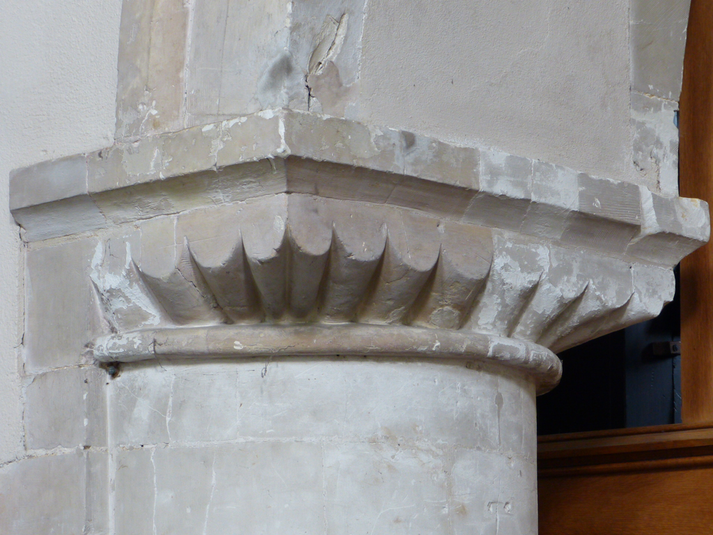
Clunch capital in the arcade at Iver
Flints, found within the chalk, were extensively used in church building, as at Great Kimble, while the Sarsen, quarried at Prestwood and Hughenden around Denner Hill was often used for paving setts.
The flint church of St Nicholas, Great Kimble
North of the Chiltern escarpment is the Vale of Aylesbury, a band of Kimmeridge Clay, and associated with it geologically are the Ampthill Clay, that forms a band running from Oakley to Stewkley, and the Oxford Clay, running from Winslow to Bletchley. Within the Vale of Aylesbury are patches of limestone, forming small hills at Ashendon, Waddesdon and the Winchendons.
The Vale of Aylesbury at Mentmore
These provide the creamy, shelly limestones used at the churches of Upper Winchendon, Cublington and Wing.
St Mary Magdalene, Upper Winchendon, built of Aylesbury limestone
Also within the clay zone are outliers of the Cretaceous Lower Greensand, providing an ironstone that is brittle and a rich brown in colour, sometimes used decoratively as at Drayton Beauchamp and Lathbury.
Decorative ironstone battlements added to All Saints, Lathbury
Finally, the Great Ouse valley extends from Buckingham to Olney in the north of the county, and it and its tributaries have produced a landscape of broad wooded valleys, mostly given over to pasture. The underlying geology is the Middle Jurassic sands and shelly limestones. The limestones quarried here are mostly coarse and crumbly, and include Cornbrash and the Great Oolite. Despite its name this is neither oolitic nor very good for building. These limestones were used locally in Buckingham and the villages near its quarries, e.g. at Olney and Weston Underwood.
Overall, then, the local stone was not of the best quality for building, and although there are some quarries in the Jurassic limestones, north and west of Aylesbury and Long Crendon, a good deal of freestone was imported from the surrounding counties of Oxford, Northampton, Rutland and Lincoln.
Communications
The county was well-served by ancient roads. Icknield Way is a pre-Roman long-distance trackway running from Wallingford (Berks), along the ridge of the Chilterns past Ivinghoe Beacon (Bucks) and passing through Dunstable (Beds) and Baldock (Herts) on its way to Knettishall, near Thetford (Norfolk). Akeman Street was the Roman road from Cirencester to London. It runs through Bicester (Oxford) and Aylesbury, following the line of the modern A41 through Aston Clinton and joining the Icknield Way just outside Tring (Herts). In the north of the county, Watling Street, the main road from London to the north west runs through Milton Keynes, Potterspury and Paulerspury on its course from Dunstable (Beds) to Towcester (Northants).
The Domesday record
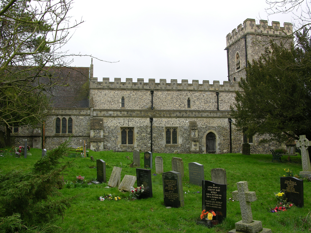
The Domesday Survey lists 18 hundreds varying in size from Bunsty, Risborough and Waddesdon, each assessed at exactly 100 hides, up to Aylesbury and Desborough with almost 150 hides each. The total number of places has been estimated at 207. The population of Buckinghamshire recorded in the Domesday is estimated at 5420, assumed to represent the number of households rather than individuals. The Domesday population density of 7.3 households per square mile is around the average for England. Settlement patterns were variable within the county, with the Chilterns forming a boundary. South and east of them the Domesday landscape was heavily wooded; nucleated settlements were generally scarce; and dispersion densities of rural settlements were variable. In these areas the population density fell as low as 2 recorded people per square mile. In the 12thc and 13thc much of this woodland was assarted producing small settlements with “end” villages like Wheeler End, whose names reflect the edge of a cleared area. To the north and west, in the Vale of Aylesbury and the area to the south of the modern settlement of Milton Keynes was the champion ground of nucleated villages and low dispersion densities in the rural areas between them. There were large open fields cultivated communally, and remains of the ancient ridge and furrow systems survive at Ashendon, North Marston and Ludgershall. Here the population density was much higher; generally between 7 and 10 people per square mile and rising as high as 11 per square mile in the Vale of Aylesbury. These variations are difficult to perceive today, owing to the growth of London and dormitories like Slough, High Wycombe and Amersham in the south, and the Milton Keynes effect in the north. Domesday recorded fisheries in 16 places in the county, and another 5 instances of mills that rendered eels. Most of these places were on the Thames and its tributaries, the Colne, Misbourne and Wye, although there were also a few in the north, on the Thame and the Ouse. Mills were likewise recorded at places on these rivers and streams, at a total of 78 of the 207 places in the county. As in many other counties, churches were not systematically recorded, being mentioned in connection with only four places: Aylesbury, Crawley, Haddenham and Buckingham. Likewise priests were not enumerated, and Campbell suggests that they were included among the villeins (Darby and Campbell 1971).
In the eleventh century, Domesday noted only two boroughs, Buckingham and Newport Pagnell, both in the north of the county, but Aylesbury was already significant by 571, when the Anglo-Saxon Chronicle recorded its capture from the Britons by the English, advancing from the east, and in 1529 it superseded Buckingham as the county town.
Buckingham, Aylesbury and Newport Pagnell
Buckingham is in the north of the county, on no major route. It was assessed at just one hide in Domesday, but there were 26 burgesses in the borough, along with 13 other households, and in 1086 it rendered £16 of blanch silver. Newport Pagnell is also in the north and was held by William fitzAnsculf in 1086. It was assessed at 5 hides, but the total number of inhabitants is not given; there were 5 villans, 9 slaves, an undisclosed number of burgesses and a tantalising reference to the “men who live in the woodland.” Its total worth was £20. Aylesbury is centrally sited on a hill at the junction of Akeman Street, the Roman road from London to Cirencester, with the main road from Thame to Buckingham. It was a demesne manor of the king in 1086, assessed at 16 hides and home to 37 men and their households. It rendered £56 and another £10 from tolls. Of the three, therefore, Aylesbury was the most valuable by a distance, even then, and although its revenue came mostly from the land, the central position on a major route made it a prime candidate for urbanisation.
Domesday tenants-in-chief
Among the greatest landowners in the county were the king’s half-brothers Odo of Bayeux (with 44 holdings) and Robert of Mortain (with 38), and two of William’s elite group of Norman magnates; Geoffrey, Bishop of Coutances (21 holdings) and Geoffrey de Mandeville (8). William fitzAnsculf was another major Norman landowner with holdings in 12 midland and western counties, including 31 in Buckinghamshire, and a seat at Dudley Castle (Warwick). Miles Crispin, with 33 holdings in the county, had a castle at Wallingford (Berks) and his holdings in seven southern counties became the Honour of Wallingford. The greatest landowner in the county, however, was Walter Giffard, Lord of Longueville in Normandy, with almost fifty holdings to his name. He held lands in ten counties (known together as the Honour of Giffard), but his power base was in Buckinghamshire and his seat was at Long Crendon. He was created 1st Earl of Buckingham, perhaps c.1097, and his lands and title passed to his son Walter at his death in 1102. Walter the 2nd Earl married Ermengarde but died without issue in 1164, when the title became extinct and the lands reverted to the crown. In 1191 the Giffard inheritance was divided between William Marshal, Earl of Pembroke and Richard de Clare, Earl of Hertford, the former getting the lion’s share including Long Crendon itself.
No other landowner had more than ten holdings, and there were a large number of single holdings including “a certain bandy-legged man” who held Evershaw in alms of the king, both before and after the Conquest.
Religious history
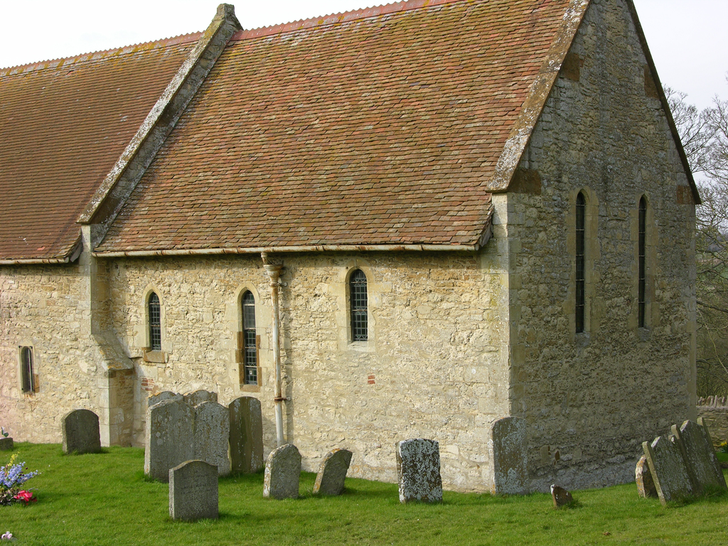
The entire county lay within the diocese of Dorchester until 1085 when the see was moved to Lincoln. Buckinghamshire remained in the Lincoln diocese until 1837, when it was moved to the diocese of Oxford (carved out of the great Lincoln diocese by Henry VIII in 1541). There was thus no cathedral within the county. St Mary’s, Aylesbury may perhaps lay claim to the greatest antiquity and prestige among its parish churches. St Edburga and her sister Edith, daughters of King Redwald of the East Angles (d.627) are reputed to have taken the veil at Aylesbury; and St Osyth is supposed to be buried there. Alternatively the Edith in question may have been the daughter of Penda, King of Mercia (d.655), and St Osyth’s aunt, while Osyth herself was buried at Chich, now St Osyth, in Essex. By the time of Edward the Confessor the church of Aylesbury and the manor in which it stood belonged to the Bishop of Dorchester, Wulfwig, as a prebend, and it was confirmed to his successors, the Bishops of Lincoln, by William I and William II. No part of the present church predates the 13thc, although VCH points out that the irregular plan of the early parts is inexplicable unless they had been added to a pre-existing structure.
In the Romanesque period there were Benedictine priories at Luffield (founded before 1133 by Robert de Bossu, Earl of Leicester) and Bradwell (founded c.1155 by Meinfelin, lord of Wolverton); Benedictine nunneries at Ivinghoe (of uncertain date, but probably before 1129), Ankerwycke (founded after 1160), and Little Marlow (probably founded in the later 12thc); a Cluniac house at Tickford, Newport Pagnell (founded 1154 or before) and a Cistercian abbey at Biddlesden (founded by Arnold de Bosco in 1147). The Augustinan canons were represented by foundations at Missenden (founded by William of Missenden around 1133) and Nutley (founded early in the 12thc by Walter Giffard and his wife Ermengarde); and the Premonstratensians by Lavendon abbey (founded by John de Bidun, who was sheriff in 1154). The Knights Hospitaller founded a small commandery at Hogshaw in the reign of Henry II, on land given by William Peverel. There were two alien priories: at Newton Longville, founded by Walter Giffard as a cell of the Cluniac house of Longueville near Rouen, around 1150; and at Wing, founded from the Benedictine house of St Nicholas, Angers at an unknown date.
Little remains of any of these. The chapel of Bradwell Abbey is largely of the 14thc. Tickford priory became a residence; the present house dating from the 19thc, and is now a residential care home, but some Romanesque stones from the old priory are built into a wall there. Nutley abbey church has gone, but parts of the cloister and conventual buildings, all dating from the 13thc or later, are incorporated into a modern house on the site. Likewise parts of Missenden abbey are built into a house, largely of the 19thc, but the abbey church is gone and nothing of the 12thc work survives. The church of St Faith, Newton Longville still stands, and the manor house incorporates material from the alien priory buildings, mostly later medieval. Little Marlow nunnery was allowed to fall into ruin after the Dissolution, but the plan has been reconstructed by the VCH. What survives is in the grounds of a modern house on the site. Ankerwycke nunnery is ruinous, and what remains, largely of the 13thc, is on the Ankerwycke estate between Wraysbury and Runnymede.
Anglo-Saxon and Romanesque buildings and sculpture
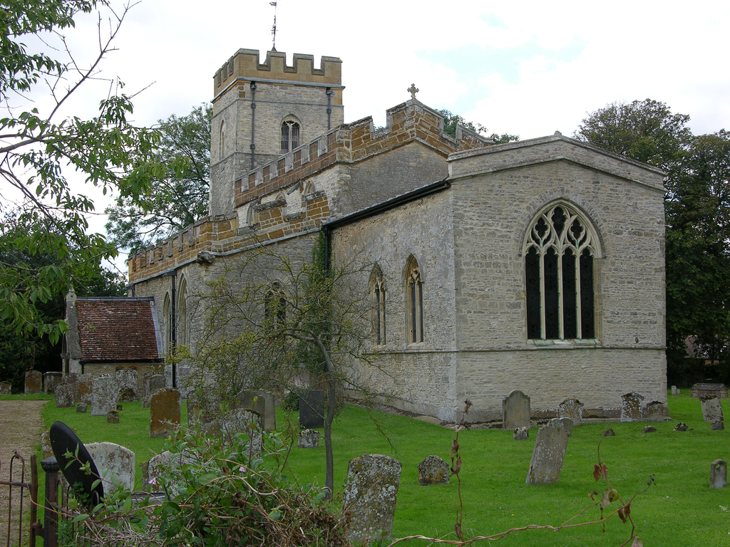
No secular buildings survive; the castles of the period being represented by earthworks, like the mottes and baileys at Cublington and Castlethorpe. The present church of St Peter and St Paul, Buckingham, was built in the late-18thc on the motte of the former castle there. The county contains one important Anglo-Saxon church in Wing, where the polygonal chancel, raised over a crypt, and the nave and aisles are all pre-Conquest work, dated variously between the 8thc and the late 10thc (37969).
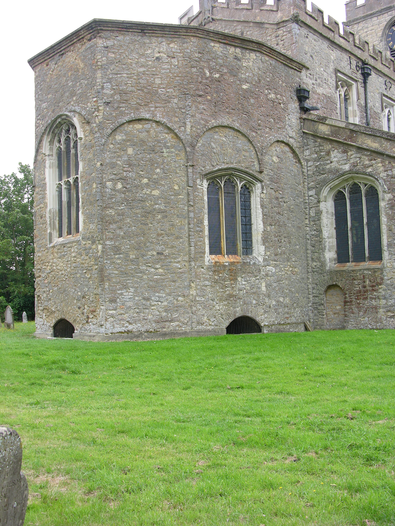
The 9th–10thc. apse of All Saints, Wing, raised above its crypt.
The towers of Bradenham and Fingest may date from the late-11thc, after the Conquest, while mature Norman architecture is represented by the churches of Stewkley and Upton, both cruciform in plan with a central tower and a vaulted chancel. Stewkley is by far the most spectacular Romanesque church in the county, with a wealth of chevron ornament on the blind arcading of the tower, the three carved doorways, the nave windows, the chancel and apse arches and the ribs of the apse vault; a corbel table with grotesque heads; beakheads on the apse and chancel arches; and a dragon tympanum over the main west portal, all of c.1140-50.
St Michael's Stewkley. the N side and a detail of the dragon tympanum
There are elaborate doorways with carved tympana at Dinton, with a Tree of Life flanked by composite lions and St Michael and the dragon on the lintel, and at Leckhampstead, with a pair of fighting beasts separated by a central figure.
Tympana with beasts at Dinton and Leckhampstead
At Water Stratford is a priest’s doorway with an Agnus Dei, and in the nave a copy of the Prior’s doorway at Ely showing an enthroned Christ with an unnerving replacement head.
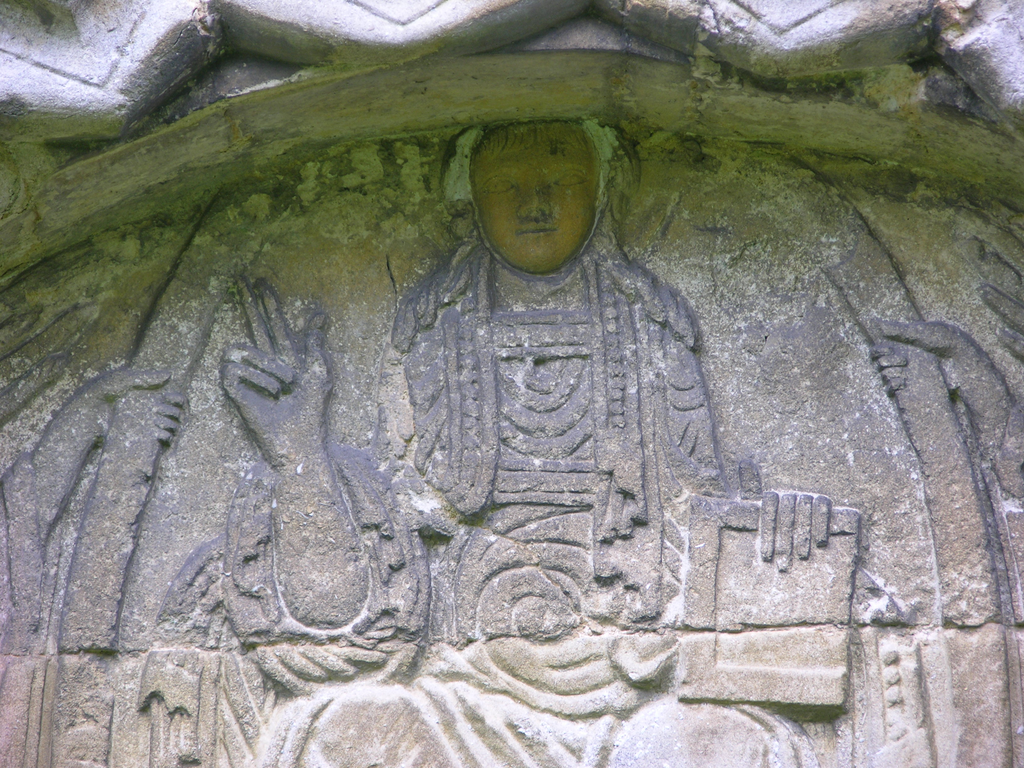
The Christ in Majesty tympanum at Water Stratford (with replacement head)
Other doorways worth study are at Horton and Twyford, while Lathbury contains a displaced tympanum with affronted beasts tangled in foliage.
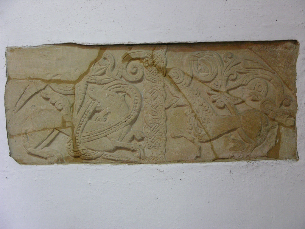
The tympanum at All Saints, Lathbury
The beakhead ornament, or its geometrical equivalent, appears occasionally in the county, at Stewkley, Bletchley, Fawley, Hanslope, Radclive and Twyford.
Beakhead ornament at Bletchley
The font at Stone is an enigmatic piece of work, with a figural scene here interpreted as a struggle with the devil for men’s souls and a fine display of knotwork designs, but it is not local, having been imported from Hampstead Norreys (Berks) in 1767.
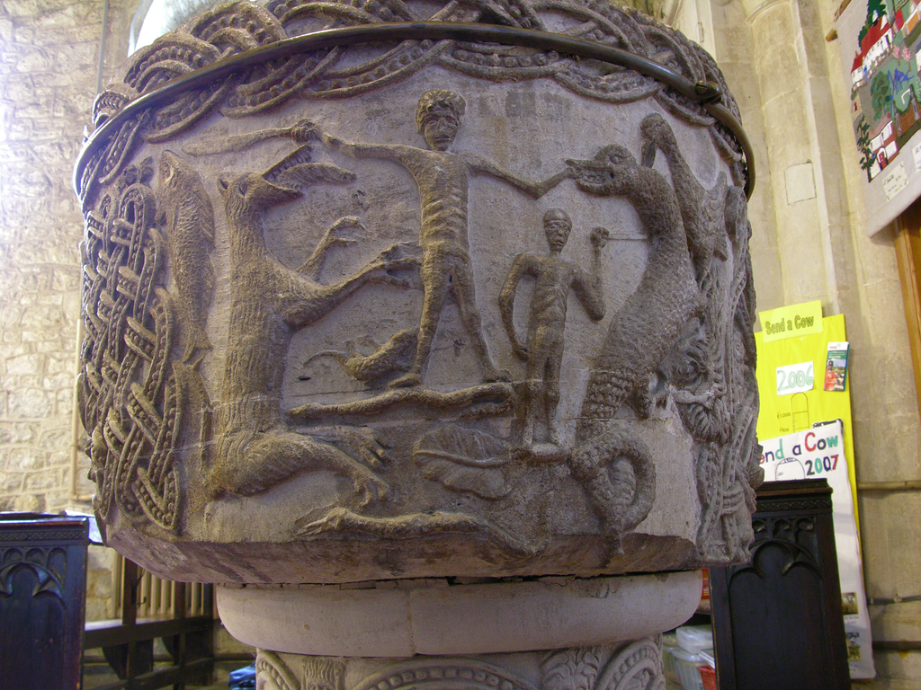
The font at Stone, a refugee from Hampstead Norreys (Berkshire)
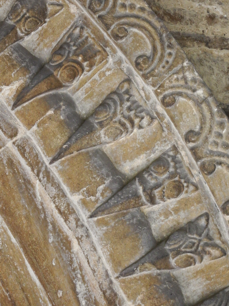
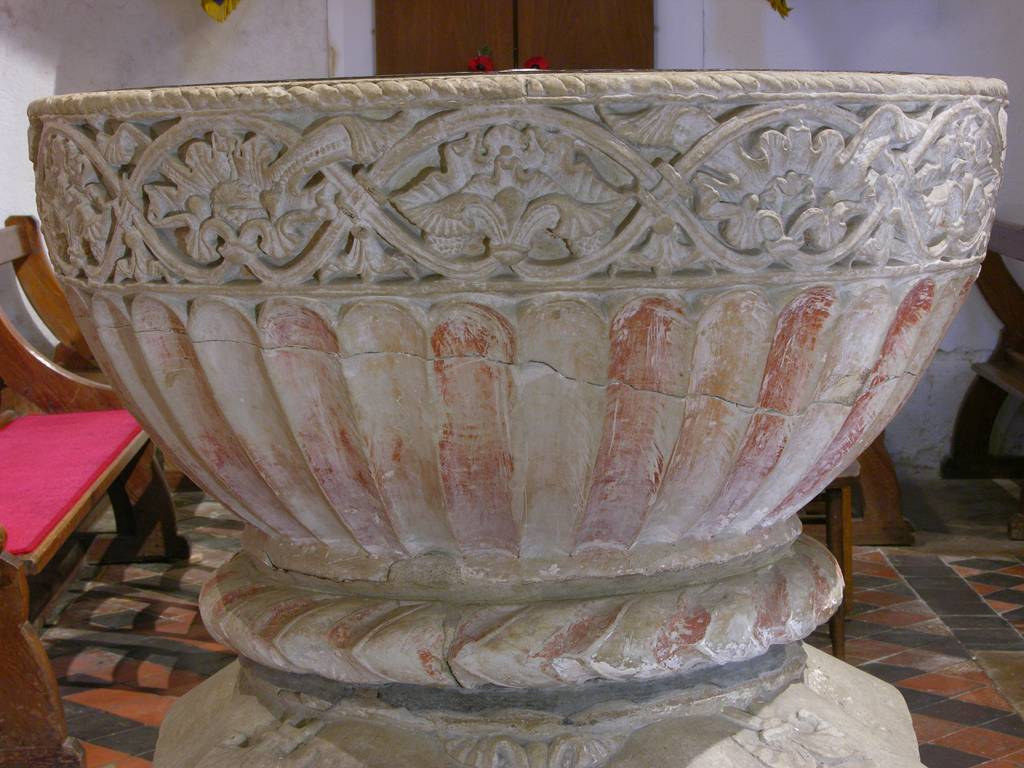
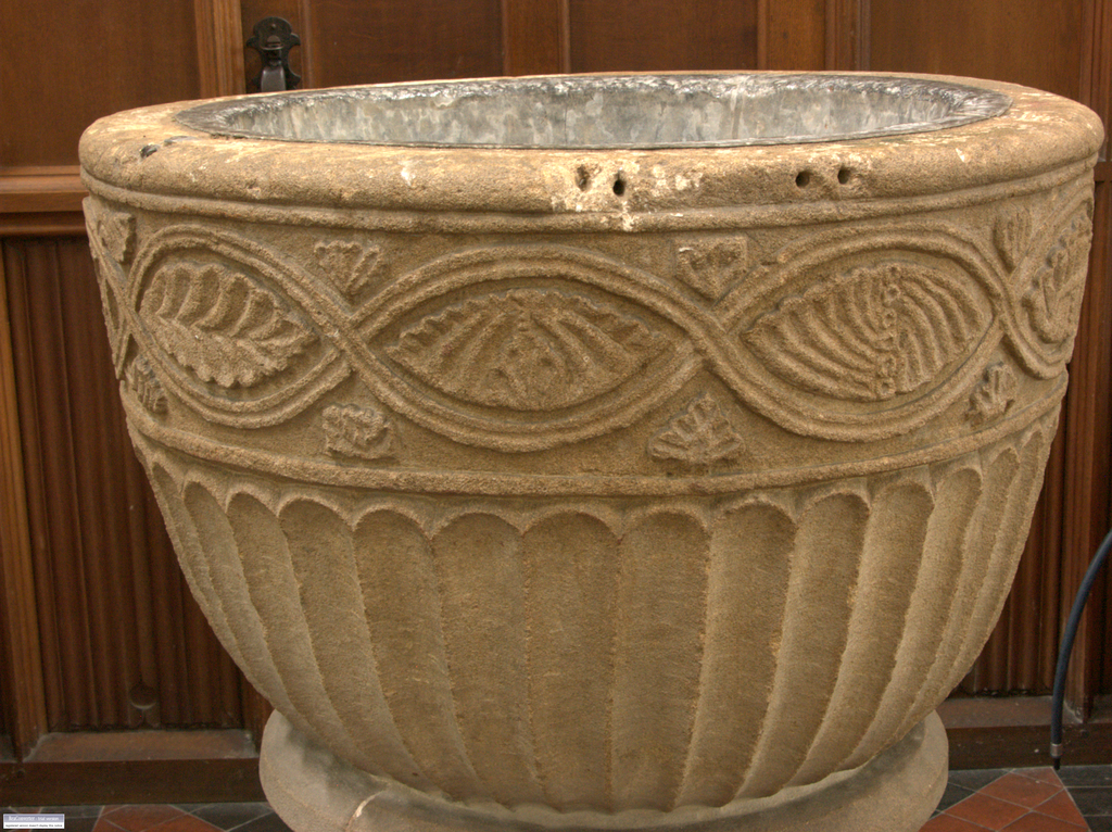
The most celebrated Romanesque sculpture in the county, however, is in the fonts of the Aylesbury group. Pevsner identified a group of 22, of which thirteen (not all complete) are in Buckinghamshire. These are at Aylesbury, Bledlow, Buckland, Chearsley, Chenies, Great Kimble, Great Missenden, Linslade, Little Missenden, Monks Risborough, Pitstone, Weston Turville and Wing. To these must be added the fonts at Ludgershall, Saunderton and Haddenham, described by Pevsner as less adept copies of the design.
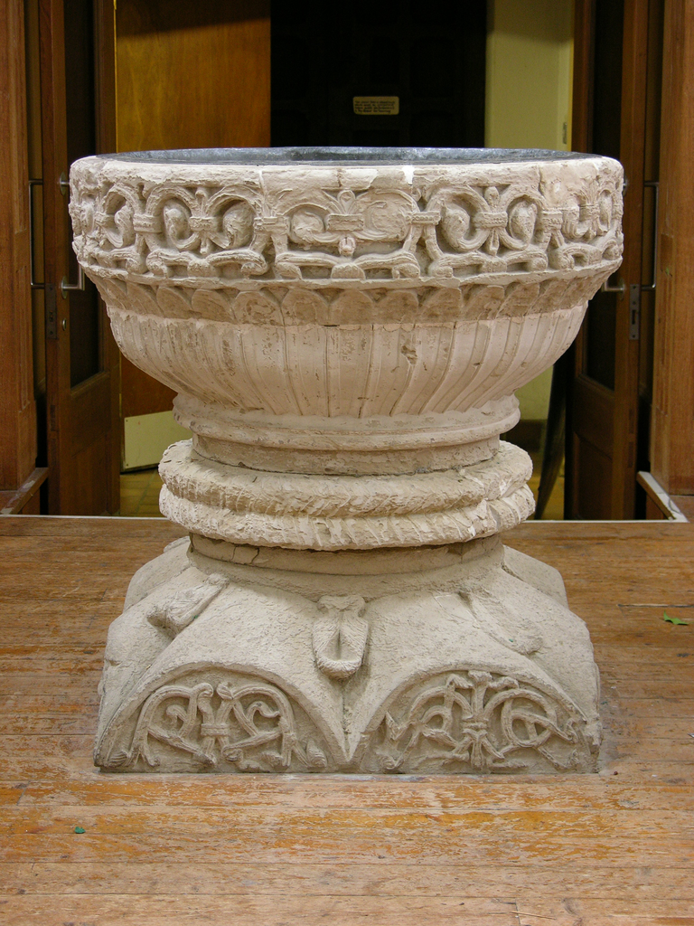
The font at St Mary's, Aylesbury
The Aylesbury group fonts have chalice-shaped fluted bowls with bands of relief carving around their upper rims and strongly projecting rolls below the bowl, sometimes decorated with cable or chevron ornament. Their bases are of single- or double-scallop form with decorated shields. At best, as at Great Kimble, Weston Turville, Chenies or Aylesbury itself the foliage carving is outstandingly accomplished and the material is always the Totternhoe stone, a clunch from Bedfordshire.
The bowl of the Great Kimble font
Outside this elite group there is a good deal of variation. At Bledlow and Monks Risborough are simplified versions, accurately carved but in lower relief and with less complex foliage designs, and both are of sandstone rather than clunch.
The sandstone font at Monks Risborough
Little Missenden is of clunch, but its rim is carved with simple dart ornament. Buckland, Saunderton and Chearsley have forms of stiff-leaf ornament on their rims, and must be later copies of c.1200, while Pitstone is inaccurately set out and has cruder foliage ornament.
Fonts at Little Missenden and Buckland (top), and Saunderton and Pitstone (below)
The font at Haddenham, inaccurately described by Pevsner, has a scalloped (not fluted) bowl and a dragon-carved rim, and may be an earlier font which served as an inspiration, to some extent, for the Aylesbury carvers. Outside Buckinghamshire there are fonts related to the Aylesbury group at Duston and Eydon in Northants, and at Barton-le-Clay, Dunstable, Flitwick and Houghton Regis in Bedfordshire. The Aylesbury fonts are normally dated late in the 12thc, c.1170-90. Thurlby has suggested, on the basis of comparisons of foliage forms on the Aylesbury and Weston Turville fonts with sculpture at St Alban’s Abbey dating from the abbacy of Simon (1167-83), and on the resemblance between these fonts and liturgical chalices, that the sculptors were copying St Albans metalwork, perhaps of the kind produced by one Master Baldwin according to an account by Matthew Paris.
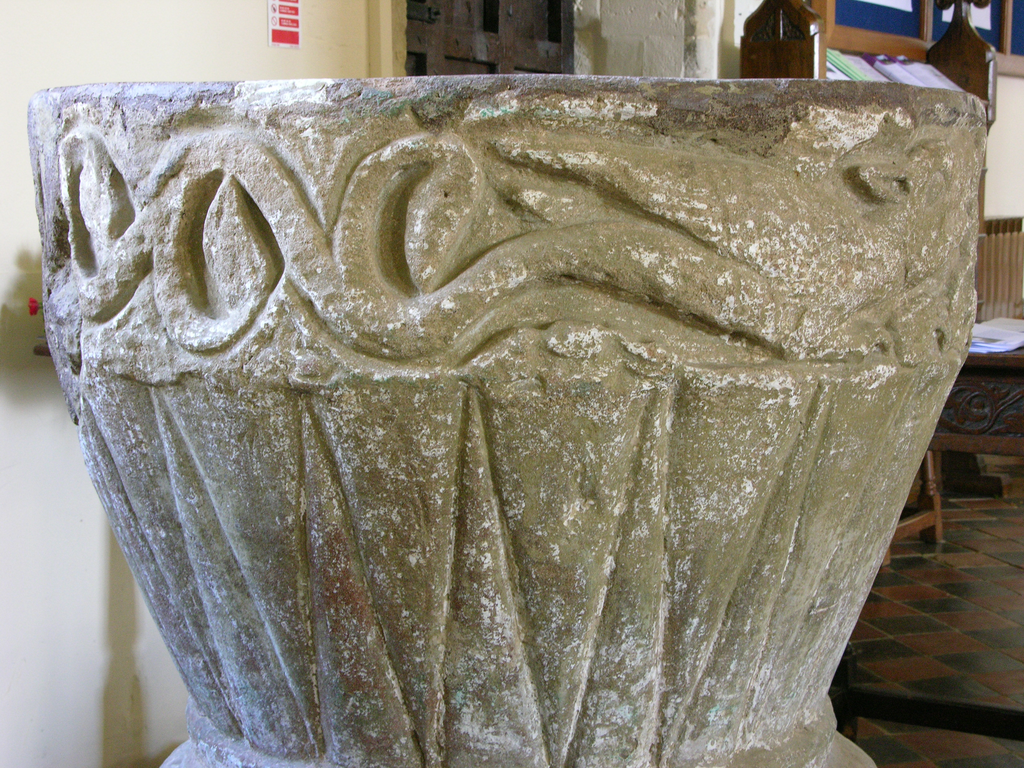
The font at St Mary's Haddenham
Fieldwork and recording
Preparatory work was carried out by Sophie Church, and the on-site fieldwork and photography by Ron Baxter, beginning in August 2006. A Nikon Coolpix 8700 digital camera was used for all photography. The images were edited and prepared for web delivery by Anna Bentkowska-Kafel and the web pages were produced by Anna Bentkowska-Kafel and Hazel Gardiner. The CRSBI would like to thank the clergy, churchwardens and keyholders of Buckinghamshire for their generous help in arranging access to the churches in their care.
Bibliography
Only important general works are listed here; works on specific sites will be found in their site entries.
- G. Lipscombe, History and Antiquities of the County of Buckingham, 4 vols. London, 1843.
- N. Pevsner and E. Williamson, Buildings of England: Buckinghamshire. London 1960, 2nd ed. 1994.
- RCHME, An Inventory of the Historical Monuments in the County of Buckingham. 2 volumes, London 1912-13.M.
- M. Thurlby, “Fluted and Chalice-Shaped: The Aylesbury Group of Fonts”, Country Life, CLXXI, 1982, 228-29.
- M. Thurlby, 'The Place of St Albans in Regional Sculpture and Architecture in the Second Half of the Twelfth Century.' in M. Henig and P. Lindley (ed.), Alban and St Albans. Roman and Medieval Architecture, Art and Archaeology. (British Archaeological Association Conference Transactions XXIV). Leeds 2001, 162-75.
- Victoria County History: Buckinghamshire. 4 volumes, 1905-27.
