Introduction
For those who do not know it well, Staffordshire means the industrial heartlands of the Potteries and the Black Country. For those that do it is a county of contrasts that retains much of its ancient character: the Pennines in the north-east, the old forest of Cannock Chase, and elsewhere a rolling wooded landscape of tiny villages and medieval market towns. Staffordshire is a West Midlands county, bordered by Shropshire to the west, Cheshire to the north-west, Derbyshire to the east, Warwickshire to the south-east and Worcestershire to the south. Its greatest length is 60 miles from north to south, and its greatest breadth 38 miles from east to west, which makes it 18th in order of area of the 39 English counties.
Landscape and Geology
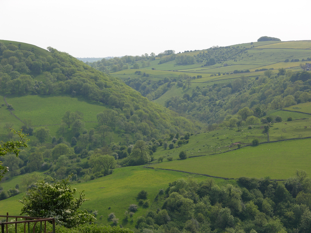
The north-eastern moorlands on the Derbyshire border form the start of the Pennine Chain that continues northwards through north Derbyshire, along the western edge of Yorkshire and on to the Cheviot Hills on the Scottish borders. They are similar to the Derbyshire Dales in character, the uplands intersected by the valleys of the Dove, Manifold, Hamps, Blyth and Dean.
The Manifold valley near Grindon
Dovedale is justly famous for its wild beauty, and forms a section of the border with Derbyshire.

View to E from Ilam towards Thorpe Cloud
The Weaver Hills, between the rivers Dove and Churnet, are the highest in the county, rising to 1500 ft (460m). In the north-west, Congleton Edge marks the border between the Staffordshire uplands and the Cheshire plain. Further south, and accounting for most of the county from Stoke to the Worcestershire and Warwickshire borders the landscape is reasonably flat and wooded and was traditionally farmed as pasture. To the south of Stafford lies Cannock Chase; once a high wooded heath 25,000 acres in extent, but now reduced in size through reclamation and largely replanted with conifers. The southernmost part of the county, around Walsall, includes an area of Silurian Wenlock limestone. This region is generally hilly but entirely covered by the urban sprawl of the Black Country.

Cannock Chase near Armitage
The chief river is the Trent, which rises near Biddulph on the Cheshire border and runs diagonally south-east to Burton-on-Trent on the Derbyshire border. It is rapid but does not become navigable until it enters Derbyshire. The Dove is a tributary of the Trent, joining it near Burton.
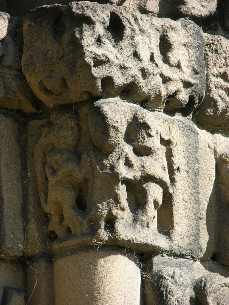
The geology of the county is dominated by the New Red Sandstone, a rock laid down in the Permian and Triassic periods between 205 and 250 million years ago, and covering the north of Shropshire, Cheshire and much of Worcestershire and Warwickshire as well as a large part of Staffordshire. There are two main strata in the New Red Sandstone, which were formerly called the Bunter and the Keuper beds. Modern geologists have abandoned these names, and divide the older, Bunter, beds into the Permian Bridgnorth sandstone which is overlaid by the Triassic strata called Sherwood sandstone, which includes the pebble beds compressed to form the Kidderminster conglomerate and the Wilmslow sandstone. The younger Keuper beds include Helsby and Grinshill sandstones which are overlaid by various marls, silts and mudstones. Like the Old Red Sandstone of Herefordshire, New Red Sandstone is not invariably red, being found in a wide range of hues from warm browns through purple to pink, yellow and grey. Unlike the Old Red, however, its beds are deep, and ashlar is readily available, especially as the stone, when freshly quarried, cuts as easily as cheese. The problem with much of it, however, is that it does not weather well especially outdoors, being subject to blistering, flaking and crumbling away. Continual replacement of the stone is necessary to keep buildings in good order, so that major buildings like the cathedrals of Worcester and Lichfield will usually be found under scaffolding in one area or another. For the historian of sculpture the New Red Sandstone presents problems. Most obviously, exterior medieval sculpture has rarely if ever survived in anything like its original condition and carved details may have been entirely erased by erosion. Even accidental effects of weathering can be confused with deliberate carving. Less obviously, it is often difficult to decide whether worn sculpture is genuinely medieval or a nineteenth-century replacement, so rapidly does the stone erode.
Erosion on the W front of St Mary's Tutbury
The New Red Sandstone is not uniformly fragile, and while many patrons, masons and sculptors appear to have been happy to accept the necessity of frequent restorations in the future in exchange for the convenience of using a local stone that was easily cut and transported, in some cases a superior stone quarried at a distance was preferred. One of the best, and most widely used of these was the New Red Sandstone from Grinshill, seven miles north of Shrewsbury (Shropshire). Here, post-Triassic faulting movements produced hilly outcrops that were easy to quarry, and the lowland site and the presence of rivers nearby, including the Severn itself, made distribution easy. The stone itself benefited from localised igneous activity that turned some of the soft, red sandstone into a harder, white version.
At Gnosall the local sandstone has been largely replaced (L) while the imported Grinshill stone remains (R).
At Bradley and Gnosall in Staffordshire, local sandstone was used for the ashlar while white Grinshill stone was imported for the sculptors . A distinctive group of Grinshill fonts spans the two counties.
Grinshill stone fonts at Bradley (Staffs) and Edgmond (Shropshire
In the north-east of the county are Millstone Grit sandstones, which are much more durable, and the carboniferous limestones of the Pennines, but because the country here is not populous, neither has found much use as building stone. Finally areas of the north-west around Stoke, and of the south in the Black Country and the southern part of Cannock Chase, are underlain by coal measures.
Population and Settlement
At the time of the Domesday Survey, Staffordshire was one of the most sparsely populated parts of England in 1086, with only 2.8 people recorded per square mile overall. Much of the county was wooded; not only Cannock Chase, but the Needwood Forest west of Burton-on-Trent, and in the south around Kinver and Enville, while the north-east of the county, on the edge of the Pennines, was not productive farmland, so effectively a good deal of the county was barely inhabited at all. Until the end of the 18thc the rest of Staffordshire was a county of hamlets and isolated farms with a medium to very high density of dispersion, served by a few market towns but without many nucleated villages. Roberts and Wrathmell (2000) describe “ancient forest landscapes, with their intricate mosaics of old-enclosed fields and woodland blocks”, and suggest that the isolated hamlets, farm clusters and moated sites may be associated with clearances that predate the Conquest.
Woodland lanndscape around the hamlet of Maer
A striking feature of the Domesday record is the large number of vills described as waste; 62 out of a total of 334, or about one in five. The usual reason for this is the effect of war on agriculture, especially the Conqueror’s rapid and violent response to the rebellions of 1069, and this seems to be the case where the Domesday waste lands were in the marginal valley areas of the northern uplands, which might be expected to take longer to recover than more fertile lands. In the south, wastage seems to have been the result of Norman afforestation, since some of the waste vills were on the edges of Cannock Chase.
As is the case for many counties the Domesday record is not a reliable guide to churches. Only two are mentioned, at Stoke and at Tettenhall, and those parenthetically.
Medieval Towns
Domesday records three boroughs in the county, Stafford, Tamworth and Tutbury, of which the county town was the most important. Other towns received borough status as early as the 12thc, including Lichfield (1154x59), Newcastle under Lyme (1173), Burton (1187x97) and Eccleshall (1199).
Stafford was built in a loop of the river Sow, a tributary of the Trent. It was fortified as early as 913, by Aethelflaeda, daughter of Alfred, brother of King Edward the Elder, and ruler of Mercia. It was recorded as the shire town in 1016, and a mint was operational from 924 to 1154. A royal castle (which does not survive) was built in 1070. The Domesday record mentions 18 burgesses in the town and a total of 161 houses, of which 110 were inhabited. Another 18 burgesses of Stafford were recorded in the entry on Marston, near Stafford, and another house in Stafford was recorded in the entry on Cresswell, so the total figures may have been 36 burgesses and 162 houses. As well as the burgesses there were 13 canons (so presumably a church), 13 villeins, 8 bordars and 4 serfs, bringing the total recorded population up to 74. For Wheatley (Darby & Terrett 1971) “these figures may imply a population of at least 750.” Three separate fairs were granted: in 1245 to William de Cantelupe, in 1261 to the burgesses of the town, and in 1412 to the bailiffs and burgesses of the town. A market was recorded in 1382, but it was clearly well-established by then, as the record includes a complaint that its trade was being damaged by unlicensed markets in nearby towns. There is a town charter of 1206, and mendicant houses were established there (Greyfriars 1274, Austin Friars 1344). Today the centre of Stafford is enclosed by a ring road but retains much of its medieval planning, around a spacious marketplace and the churches of St Mary and St Chad. Greengate Street, running south from the market, contains several timber-framed buildings including the spectacular High House. Its population in 2003 was 121,800.
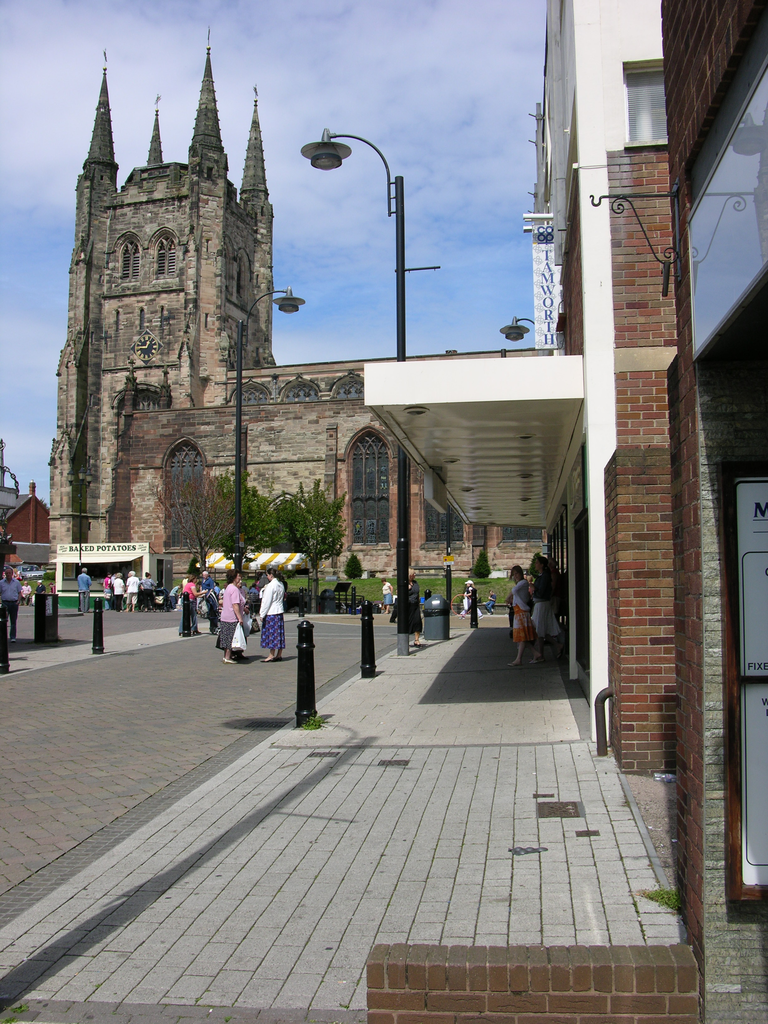
Tamworth stands on the river Tame, which anciently formed the border with Warwickshire. The old centre is on the Staffordshire side, and as the town expanded southwards across the river it was split between the two counties. This was rectified by moving the border in 1888. Tamworth’s recorded history begins in 781, the date of a charter of Offa, King of Mercia that was signed in his palace there. The town was fortified by Aethelflaeda in 913. Its castle, with a Norman shell keep, was granted to Robert de Marmion by the Conqueror, and the large parish church of St Editha has indications of an Anglo-Saxon crossing tower and a good deal of Norman masonry. The Domesday record of the town is scanty, with no entry specifically relating to it, but there are records of burgesses of Tamworth elsewhere; 4 from Wigginton, 10 from Coleshill (Warwicks) and 8 from Drayton Bassett. A mint operated here from 924 to 1154, and there was a prescriptive borough market, recorded in 1392 as held by the bailiffs and commonalty of the borough. A fair was granted to the men of the town in 1336. The town grew rapidly in the 18th and 19th centuries, due largely to the surrounding coal mines, and it also became a hub of the canal network, with the Coventry Canal and the Birmingham and Fazeley Canal being built through the town. Later the railways arrived with the Midland Railway route from Derby to Birmingham (1839), and the London and North Western Railway (1847), which provided direct trains to the capital. After the 1939-45 war a good deal of rebuilding was necessary, and the town also grew as the Birmingham conurbation expanded. Its population in 2003 was 74,200.
St Editha's Tamworth in its urban setting
Tutbury is in the Needwood forest, on the river Dove which forms the Derbyshire border. After the Conquest it was given to Henry de Ferrers, who built the priory and the castle which formed the focus of the medieval town. A prescriptive borough market was recorded in the Domesday Survey, where it was recorded that 42 men were earning a living from it, but by 1203 it had been removed. The priory was a Benedictine alien foundation, with a prior and twelve monks from the abbey of Saint-Pierre-sur-Dives in Normandy, founded in the 1080s or ‘90s. Like all alien priories it suffered during the Hundred Years War, when it passed to the king, and it never really recovered. It was dissolved in 1536. The town stayed in the Ferrers family until 1250 when Robert de Ferrers forfeited it for his part in Simon de Montfort’s rebellion against Henry III, when it was given to Edmund, Earl of Lancaster, the king’s son. It again passed to the crown when Thomas of Lancaster rebelled against Edward II in 1332 the castle fell into ruins but was rebuilt by John of Gaunt in 1350, and the honour and castle passed to his son, later Henry IV. Mary Queen of Scots was imprisoned there on five occasions between 1568 and 1585, but by this time the castle was dilapidated, and she complained several times about the unsanitary conditions. The castle was a Royalist stronghold during the Civil War, and was thus pulled down by Cromwell when it finally surrendered in 1646. With the priory and the castle gone, Tutbury did not prosper after the Middle Ages, as the other Domesday boroughs did. In 1861 its population was just 1,982, and in 1868 the National Gazetteer described it as a decayed market town. It is now best described as a large village, with a population of approximately 3,000.
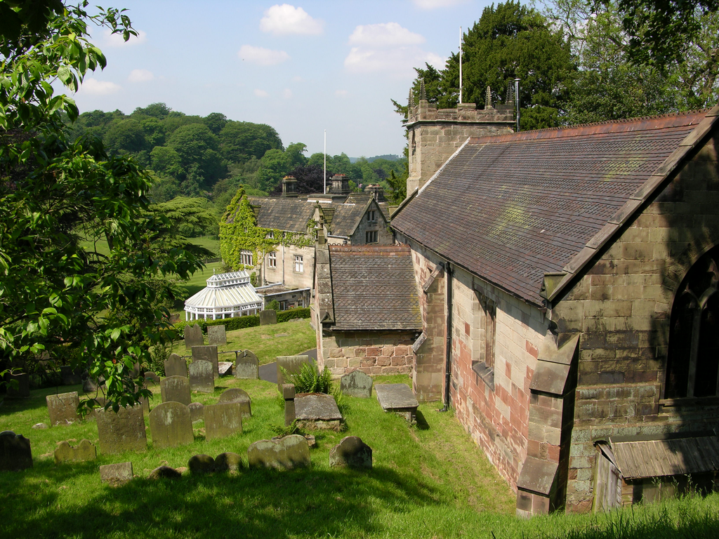
Lichfield had its beginnings in the Roman town of Letocetum, at the crossing of Watling Street and the Icknield Way. The village of Wall now occupies this site. According to Bede, St Chad moved his bishopric of Mercia to Licidfelth in 669, and when Chad died in 672 his shrine attracted pilgrims. Bishop Hedda began a new cathedral in 700, and the present cathedral is assumed to be on the same site. This is two miles to the north of the Roman settlement. The diocese was briefly transferred to Chester (1075-95), and then to Coventry before being jointly held by Coventry and Lichfield. The reconstitution of the cathedral chapter dates from 1130. The town too retains its medieval street pattern and its centre boasts two large pools, Minster Pool (the Bishop’s Fish Pool) and Stowe Mere that divide the close from the city. The prescriptive borough market and fair, held by the Bishop of Lichfield, were recorded in 1293 but were clearly older. A market was granted 1149x54 to the church of Lichfield and the Bishop of Coventry; and fairs on different feasts were granted in 1307 to Bishop Walter de Langeton, and in 1337 to Bishop Roger. Apart from the cathedral, Lichfield has medieval churches in St Chad’s and St Michael’s. The hospital of St John was founded c.1140, and the Franciscan friary c.1240. The centre retains impressive timber-framed buildings, and a good deal of Georgian architecture. Its population in 2003 was 93,900.
Administrative history, parishes and hundeds
The boundaries of the county were somewhat fluid during the middle ages, so that by the end of Henry II’s reign a group of Domesday vills on the western border; Alveley, Kingsnordley, Claverley, Worfield, Cheswardine and Chipnall, had been transferred to Shropshire, while Upper Arley was transferred to Worcestershire, suggesting that the Severn ceased to be the county boundary at that time. In modern times the growth of population around Birmingham resulted in the transfer of Perry Barr, Handsworth and Harborne from Staffordshire into Warwickshire. Tamworth has always been problematic, as described above. In the east, Edingale, Croxall, Stapenhill and Winshill which were recorded in the Derbyshire Domesday folios were moved to Staffordshire in the 19thc.
The Domesday Survey mentions 334 places in Staffordshire, divided among the five hundreds of Totmanslow, Pirehill, Cuttlestone, Offlow and Seisdon.
Domesday tenants-in-chief
Staffordshire was split between a relatively small number of tenants-in-chief in 1086; ignoring single holdings and small multiple ones, there were only twelve. Apart from the king, the greatest lay landowners in 1086 were Robert of Stafford (with 69 holdings), Roger Montgomery, Earl of Shrewsbury and William fitzAnsculf (31 holdings each). Roger Montgomery was one of the greatest of the Norman tenants-in-chief. He was related to the Dukes of Normandy, and after the Conquest he was given strategically important lands in Sussex (the rape of Arundel) and most of Shropshire along with the earldom of Shrewsbury, as a bastion against the Welsh. He also held estates in Surrey, Hampshire, Wiltshire, Middlesex, Hertfordshire, Gloucestershire, Worcestershire, Cambridgeshire, Warwickshire and Staffordshire. He died in 1094; the earldom and the bulk of the English estates passing to his second son Hugh, and at his death in 1098 to the eldest son Robert de Belleme, who had already inherited his father’s estates in Normandy. William fitzAnsculf, son of Ansculf de Picqigny, was another major Norman landowner with holdings in 12 midland and western counties, and a seat at Dudley Castle (Worcestershire). On his death the estates, castle and title passed to his daughter Beatrice, married to Fulk Paynell, and when the Paynell male line died out to the de Somerys, through marriage to Hawise, sister and heir of Gervase Paynell. In 1194 her son Ralph de Somery succeeded to the barony. Later, in the early 14thc, the barony and castle passed by marriage to the Suttons.
Robert of Stafford, otherwise Robert de Tosny, was an important Domesday tenant with holdings in Staffordshire and in 5 other counties. He was the son of Roger de Tosny and the younger brother of Ralph de Tosny, another important Domesday tenant. He became known as Robert de Stafford from his residence at Stafford Castle, and his estates passed from father to son until the death of another Robert Stafford in 1185, when the male line failed and the inheritance passed to a daughter, Millicent, who married Hervey Bagot, a knightly tenant who succeeded to the fief in her right in 1194. Their descendants took the name of Stafford, and in 1299 Edmund de Stafford was granted a barony. He died in 1308 and his descendants, beginning with his son Ralph (d.1372) were created Earls of Stafford. Of the smaller secular landlords mention should be made of Richard the Forester, who held nine vills by virtue of his hereditary office as royal forester of Cannock. Richard’s daughter and heir married William Croc, and their son Walter succeeded to office and lands by 1130. When the last Croc heir, another William, was hanged in the late 12thc, title passed to Robert de Brock, husband of his sister Margery. Later the holdings passed by marriage to the Loges family, remaining in that line until the death of Richard de Loges in 1300.
The greatest of the ecclesiastical landlords was the Bishop of Chester, who had 46 holdings of which 17 were waste at the time of Domesday. The other chief religious landlords were the canons of Wolverhampton, with 18 holdings, and the Abbey of Burton, with ten.
Staffordshire and the industrial revolution
The largest towns in Staffordshire today are Stoke-on-Trent (237,900), Walsall (253,500), Wolverhampton (251,462) and West Bromwich (136,940); the first formed of the loose agglomeration known as the Potteries in the north of the county, and the others in the so-called Black Country of the south.
There are extensive coalfields in the north, around Stoke and the Potteries, and in the south, giving the Black Country its name. These, together with the iron ores that alternate with the coal seams, formed the traditional basis of Staffordshire’s industry and wealth. Major ironworks were established at Tipton, Wolverhampton, Bilston, Wednesbury and Sedgeley. The other industry for which the county is famous is, of course, the manufacture of earthenware and china. It was centred on the Five Towns of Burslem, Fenton, Hanley, Longton, Tunstall, plus Stoke. Pottery was a medieval industry here, but production before the 18c was on a village scale and Josiah Wedgwood’s ancestors were involved in this. His Etruria factory, opened in Hanley in 1769, was the first of the large factories. The Five Towns have since merged into the accretion that is the City of Stoke-on-Trent, but as Pevsner pointed out in 1974, neither Stoke nor any of its constituents has much in the way of a central focus. Neither does any of the Five Towns have a medieval church surviving.
In 1777 the Trent and Mersey canal was opened to speed distribution of the products of the potteries, and by the mid-19thc the county was criss-crossed by canals and railway lines serving the industrial centres of the Potteries and the Black Country. Many do not survive, but of the canals the Shropshire Union and the Trent and Mersey have been reinvented as a leisure resource.
Religious buildings
Lichfield Cathedral is, of course, the chief religious building of the county. The diocese now covers the whole of Staffordshire and most of Shropshire, and is divided into the archdeaconries of Stoke, Lichfield, Walsall and Salop. The medieval diocese of Mercia was much larger, including Cheshire, Derbyshire and most of Warwickshire too, and was centred Lichfield until 1075 when it moved to Chester. Around 1086 it was removed again, to Coventry, and in 1121, Robert Peche was created Bishop of Coventry and Lichfield, and the see was removed to Lichfield in 1188 (although it retained the same name). In 1836 the Coventry portion of the see was united with the see of Worcester, not achieving independent status until 1918. The present cathedral of Lichfield contains nothing earlier than c.1200-20, and its fabric is therefore outside the scope of this corpus. Romanesque carved stones do survive, however, that were reused in the Gothic cathedral and discovered in later restorations. Lichfield suffered more than any other cathedral in England during the Civil War, and has been practically rebuilt twice since; in 1661-69 and, by Wyatt, in 1788-95. Further restorations by Smirke (1842-46) and the Scotts (1857-1901) have ensured that little of the present church is genuinely medieval.
Of the monastic foundations, the most substantial survival is the Benedictine alien priory of Tutbury. The early 12c nave and the west front of c.1150-60 are important Romanesque works.
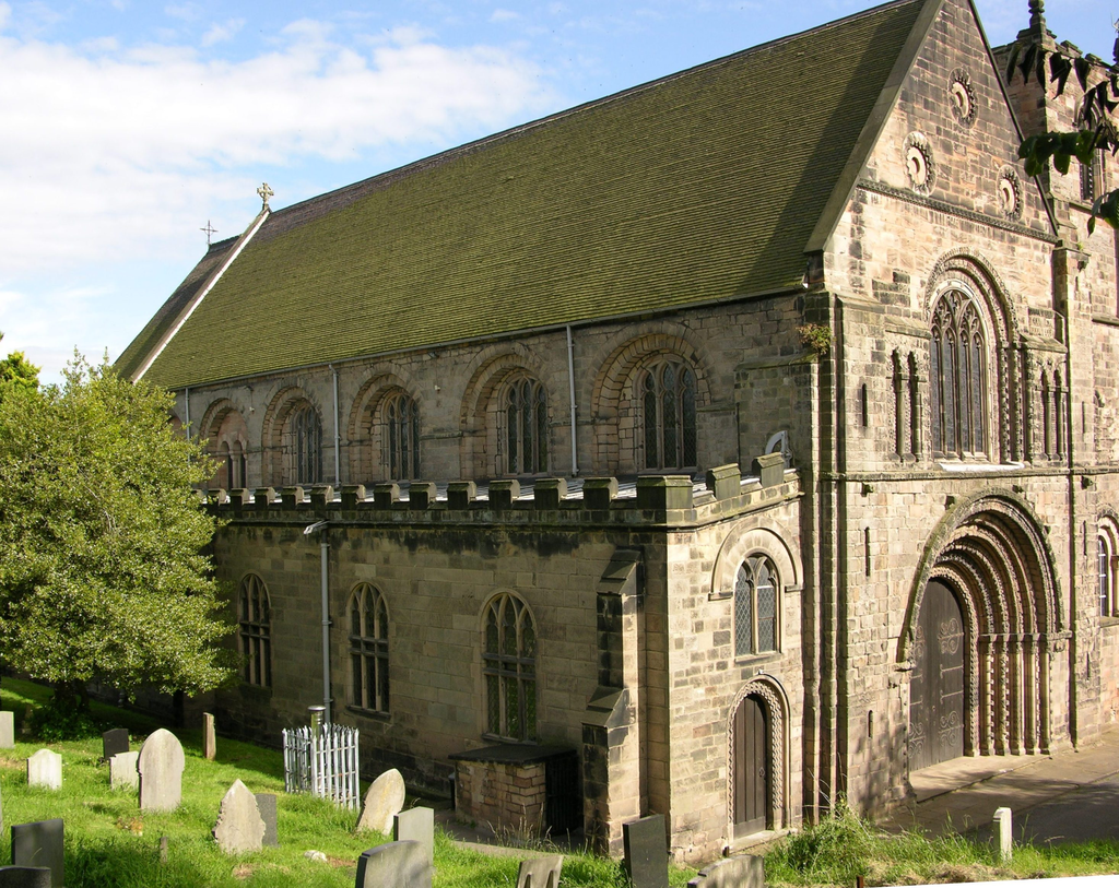
St Mary's Tutbury
Secular buildings
The castles of Alton, Tamworth and Tutbury all retain some Norman fabric. Alton is substantially a building by Pugin on medieval foundations. Tamworth retains its Norman shell keep, and Tutbury its free-standing chapel.
Romanesque sculpture
There are fewer than fifty sites in the county with Romanesque sculpture surviving, and this must be due to the available stone; soft New Red sandstone for the most part, that has weathered away, or the hard and intransigent carboniferous stones of the Pennines. What survives, however, is often of the highest quality, indicating a series of accomplished workshops extending throughout the 12thc. The parish churches of St Chad, Stafford and St Lawrence, Gnosall (formerly collegiate) preserve their Romanesque elevations.
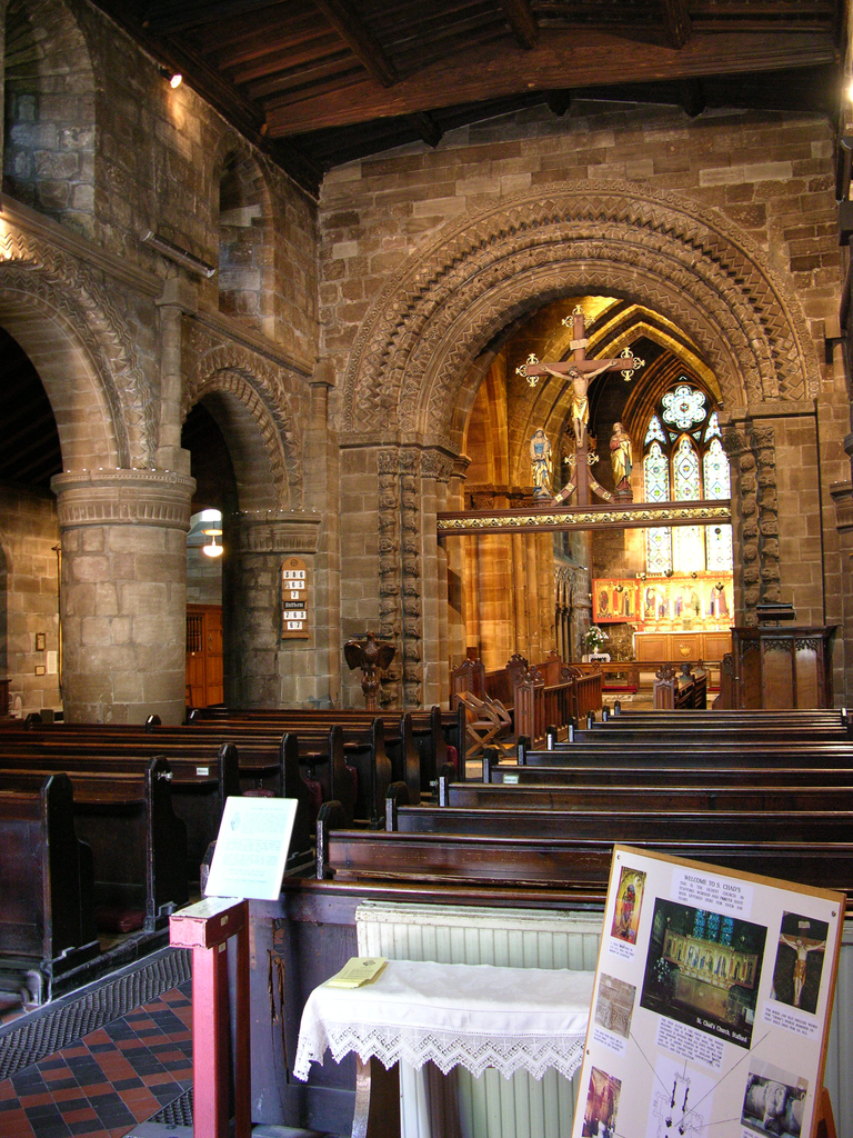
The 12thc interior of St Chad's, Stafford
Gnosall is a valuable example of a cruciform church of c.1100. Aisles and other accretions are later, but the internal transept elevations remain, with carved capitals that include Ringerike, volute and other early foliage decoration, and carved stringcourses survive from the same campaign.

View into the S transept at Gnosall
Tutbury provides an example of the elaborate carving of the 1150s, with a rich display of chevron, beakheads and figural and foliage capitals, all sadly eroded (31139).
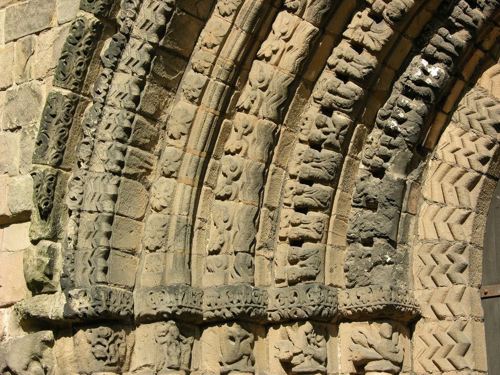
Beakhead, chevron and much more on the W doorway at Tutbury
There are more or less elaborate Romanesque doorways at Longdon, Mayfield and Swynnerton.
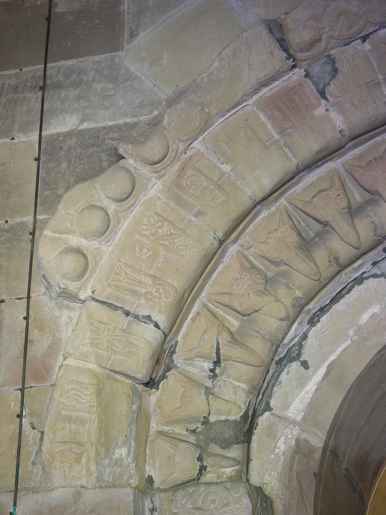
A detail of the W doorway at Swynnerton
Pevsner singled out the Norman fonts of Staffordshire for special notice, and in addition to the ones already mentioned, those of St Mary’s, Stafford, Checkley, Hamstall Ridware, Wolverhampton (Bushbury), Ilam and Armitage are particularly fine.
Fonts at St Mary's Stafford, Checkley and Hamstall Ridware (top); Ilam and Armitage (below)
An early tympanum at Ipstones, reset in the nave wall, shows a pair of fighting beasts in low relief with jerkily-curving tails, but the most striking piece of Romanesque sculpture in the county is the tympanum of St Michael and the dragon at Kingswinford, reset in the vestry.
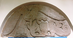
St Michael and the Dragon at Kingswinford
Fieldwork and recording
Our earliest fieldwork was carried out by the late Geoffrey Pearson, who recorded nine sites between February and April 1994. Following Geoff’s death, fieldwork was resumed by Ron Baxter in June 2005, and in this phase a Nikon Coolpix 8700 digital camera was used for all photography. The images were edited and prepared for web delivery by Anna Bentkowska-Kafel and the web pages were produced by Sophie Church and Anna Bentkowska-Kafel. The authors would like to thank the clergy and churchwardens of Staffordshire for their generous help in arranging access to the churches in their care.
Short bibliography
- P. Wheatley, “Staffordshire” in H. C. Darby and I. B. Terrett, The Domesday Geography of Midland England. Cambridge 1954, 2nd ed. 1971, 163-216.
- B. A. Hains, British Regional Geology: Central England, London (HMSO) 1969.
- S. A. Jeavons, “The Fonts of Staffordshire”. Transactions and Proceedings of the Birmingham and Midlands Archaeological Society. LXVII (1947-48).
- N. Pevsner, The Buildings of England: Staffordshire. Harmondsworth 1974.
- B. K. Roberts and S. Wrathmell, An Atlas of Rural Settlement in England. London 2000.
- S. Shaw, The History and Antiquities of Staffordshire. 1798-1801. 2 vols. repr. 1976.
Victoria County History: Staffordshire. 12 vols
- W. White, History, Gazetteer and Directory of Staffordshire. 2nd ed. Sheffield 1851.
Web resources
The Staffordshire Views Collection is a collection of antiquarian prints and drawings in the William Salt Library, Stafford; a collection of 3,200 items of which 2,684 are available online and topographically searchable (https://www.staffordshire.gov.uk/Heritage-and-archives/Collections/Staffordshire-Views.aspx)
Strolling Through Staffordshire is Craig Thornber’s site containing high-quality photographs of, at present, 69 historic sites in the county.
https://thornber.net/staffs/index.html
-
