The Corpus of ROMANESQUE SCULPTURE in Britain & Ireland

St Giles (medieval)
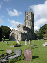
Parish church
Leigh-on-Mendip is about 5 miles from Frome and Shepton Mallet. At about 200m OD up on the E Mendips, the large linear village occupies reasonably level land on a broad W-E ridge to the SW of the large limestone quarry of Halecombe. Disused quarries lie to the N and S, the latter adjacent to Downhead; indeed, the surrounding area is punctuated by them. 500m S of the village runs the old main road between Wells and Frome. The church was rebuilt c1500 but contains a Romanesque font.
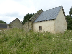
Ruined parish church
Downton on the Rock is a small village on the W bank of the River Teme, on a hilly site in north Herefordshire, 5 miles W of Ludlow. Old St Giles, with which this report is concerned, was formerly the parish church and stands in the centre of the parish. In 1861 a new church was built at the N end of the parish, about a mile to the NE, and since then the old church has been allowed to fall into ruin. By the time it was recorded by the RCHME in the early 1930s it was already in a ruinous state, but a N doorway was described as 12thc that no longer survives. It is of local sandstone rubble and consists of a nave that is largely roofless but has both its gabled end walls. The side walls are largely fallen. The chancel is newly roofed and rendered. The only surviving 12thc feature is the chancel arch.
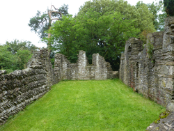
Ruined parish church
Edvin Ralph is in the NE of the county, 3 miles N of Bromyard. The landscape here is hilly and wooded; the topography governed by the valleys of the river Frome and its tributaries. The hamlet of Edvin Loach consists of a few houses and the church on a minor loop of road. The present church is of 1859-60 by G. G. Scott, but the ruin of the old church still stands, roofless, to the east, within the bailey of a castle enclosure. It consists of an unaisled nave and chancel with a west tower. The 11thc nave has herringbone masonry in the walls, which are of local sandstone rubble. Parts of the N and S walls and the entre E wall were rebuilt in the 12thc, and this work includes thesouth doorway of tufa, which is the only Romanesque feature described here. The tower, open to the nave, dates from the 16thc. The broken remains of a partly Romanesque font were described by RCHME (1932), but the font had been removed by 1986.
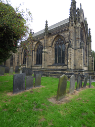
Parish church
The church consists of a nave, a large chancel, and a tower surmounted by a lower spire at the W end. The chancel was rebuilt in the 14thc. The W tower dates to the 13thc. The church was restored in 1855 and 1866.
The Romanesque features are the S doorway, the chancel arch, and two nave windows.
Parish church
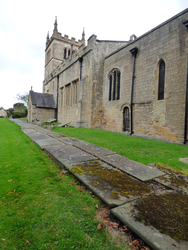
Within the district of Bolsover, this church is substantially 13thc with later alterations and some 19thc restoration. Romanesque features are the S doorway to the nave and the priest's doorway to the chancel; both have sculpture. The responds of the chancel arch are Romanesque, with scalloped capitals. The Transitional N arcade has nailhead on the abaci.
Parish church
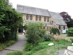
The present church of St Giles, Castle Street was rebuilt in 1875 to the design of T. H. and F.Healey of Bradford on a site slightly to the N of the medieval church that it replaced. The old church was founded 1092 (see History), and consisted of a nave, chancel, N transept and S porch, to which was added a large N annexe early in the 19thc. This was pulled down when the present church was built, but its chancel arch was re-used at the E end of the S nave aisle, and a doorway, perhaps based on the old S nave doorway but constructed of stones of various periods, was inserted at the E end of the N aisle to serve as the vestry doorway. These two features are described below.
The church of 1875 has a 4-bay aisled nave with clerestoreys. The aisles continue alongside the 2-bay chancel, providing a S chapel and a N vestry.
Parish church
The 2011 census counted 104 persons in Bratton Seymour village. The parish of 1,374 acres (historically fluctuating between c.1,000 and c.1,500 acres following boundary changes) is situated in South Somerset District, contiguous with the parish of Wincanton, the nearest small town. In the far east of the county, this area is close to the ancient boundary of Selwood Forest and the present border with Wiltshire: Penselwood village is only about 8kms distant. This moderately hilly district is reasonably prosperous agriculturally, concentrated on dairy-farming with a little arable.
A cursory glance at a map will show that Bratton Seymour, together with many other comparably sized villages, sits within a triangle formed by three small towns at the apexes: (clockwise) the aforementioned Wincanton 3.5kms ESE, Castle Cary 4.5kms NW and Bruton 5kms NNE; all three are well connected by reasonably good roads, Bratton Seymour itself being sited a very short distance (200m-1km) N of the A371 Castle Cary-Wincanton road (part of the long-distance route between the Bristol and English Channels or Bristol and Poole). The A303 trunk road, nationally important because it forms part of a popular route between London and the South West Peninsula, runs E-W past Wincanton (until recent times, of course, passing through the town) and is easily accessible by lanes from Bratton Seymour at a distance of only 3kms. Railway access, at Castle Cary, is almost as easy for Bratton Seymour residents: reasonably frequent services are available along the main line between London Paddington and Exeter and beyond; there are also more local services on the Heart of Wessex line between Bristol and Weymouth, which services also stop at Bruton.
The Domesday entry for the settlement spells the place-name ‘Broctune’, which has led to the probably erroneous inference that the ‘tun’ is named after a badger-sett (e.g., by Stephen Robinson in his ‘Somerset Place-Names’, Stanbridge 1992). More erudite and reliable information suggests that the place-name belongs with a common set in which ‘Bratton’ simply means ‘Brook-town’ after Old English ‘broc’=’brook’ (e.g., ‘The Vocabulary of English Place-Names’ volume 2, p. 37, published by the English Place-Name Society at Nottingham in 2000). This must imply that the nameless stream which rises 200m SE of Manor Farm, turns increasingly away from the settlement following a NE direction, runs down towards the Shepton Montague valley where it joins the river Pitt, which flows down to Cole to join the principal Somerset river Brue about 4.5kms away from Bratton Seymour Manor Farm, was originally considered far more significant than can now be believed. The ‘Seymour’ qualifier is a corruption of the French ‘Saint-Maur’, the family name of the local landowner who is supposed to have taken possession of the manor in the fourteenth century.
A more obvious topographical distinguishing feature (than the brook) is Bratton Hill (184m OD) along whose eastern side the settlement is strung along a lane striking north from the junction (at Jack White’s Gibbet) with the A371. This lane runs generally downhill from the main road (157m OD) past Church Farm (140m OD), whence it descends more steeply to Shepton Montague. The church is perched above the road, on the W side, at about 145m OD; even higher is Bratton House, towards the summit of the hill. Not exactly but almost, the village lane follows the geological boundary between the Forest Marble of the higher ground and Fuller’s Earth below. (Hereabouts, the geology is characterised by the N-S Jurassic strand.) Map-readers may be forgiven the notion that the altitude of the church must give good views but they would quickly be frustrated on site by neighbouring trees: only the NE aspect is fully rewarding.
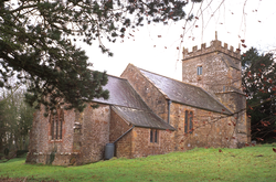
The church is constructed of local uncourse rubble with Doulting and hamstone dressings, and consists of a 2-bay chancel with a N vestry and a 3-bay nave with a W tower and a S porch. Romanesque sculpture is found on the S doorway and the arch of the S porch, the font and reset stones in the external N and S walls of the nave.
Parish church
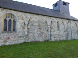
The church is composed of a simple nave and chancel in one; it was ‘largely rebuilt in 1792’ (Pevsner & Neave 1995, 324). The 18th-century rebuild made a W doorway, and three round-headed windows in the S and E walls, all of which re-used 12th-century remnants. The church avoided a Victorian restoration, even though plans for restoration were sketched by Temple Moore and never acted upon. Until recently the outside walls were painted white, which resulted in a deterioration of the stonework.
A restoration of the exterior walls was completed between 2005 and 2015 with the assistance of English Heritage. The restoration clearly illustrated that the north arcade was of a 13th-century date; it also exposed four fragments of a twelfth-century string-course which was reused in the E wall. It was found that the arcade, and therefore the nave, had formerly continued one bay west, while the position of the original S doorway is suggested by the presence or absence of a simple plinth course in the (now) W bay of the nave.
Reused original parts outside include a hoodmould over the E window; a single beakhead reset as a keystone at the apex of each of the two S windows; another beakhead and a few voussoirs with an unusual chevron moulding at the head of the W doorway. There is nothing from the Romanesque period to be seen inside the church, which is simple and appears never to have had a chancel arch.
Parish church
Noke is a small hamlet 5 miles NE of Oxford and 1 mile SE of Islip. The present church is a small stone building, much restored, dating mainly from the 13thc. It comprises a 13thc. chancel, nave and S porch, and a 19thc. bell turret. It has a plain tapered limestone font of indeterminate age.
Parish church
Bletchingdon is located in N Oxfordshire, midway between Oxford and Bicester. The present church has a 13thc. chancel and a Perpendicular nave and W tower. It was much restored in the 19thc. There is evidence of earlier work in the blocked round-headed arch of a lancet-sized window on the N side of the chancel, and the Romanesque stone fragment of star-in-square carving, probably from a lintel, mounted on the outside of the S wall of the nave.
