The Corpus of ROMANESQUE SCULPTURE in Britain & Ireland

unknown (medieval)
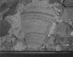
The medieval church at Knocknacloy no longer exists, and the site has not been identified (the NGR reference given is approximate). However, in 1940 Oliver Davies and T. G. F. Paterson published a description of two fragments thought to be from this building. The current location of these fragments is not known.
Parish church
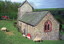
Only 3 km as the raven flies from the relatively large and accessible village of Porlock, Stoke Pero church — at just over 300 m above OD, perched on scant pasture on the very edge of Exmoor, with only one farm nearby — is remote and not easily accessible. As a notice in the porch claims: ‘The most isolated and highest church of Exmoor, 1013 feet above sea level.’ This altitude gives superb views in good weather across the Bristol Channel to Wales and up it to the rest of the Somerset coast as far as Portishead and even to Gloucestershire on the W side of the Severn. This is very rough terrain, the N flank of Exmoor on which Stoke Pero church stands is many-folded into deep combes with their hanging oakwoods and rushing streams: picturesque to the ‘romantic’ degree.
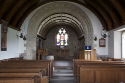
The church consists of a W tower, an undivided nave, a chancel and a N porch. The Romanesque sculptural elements consist of the font and the tower arch.
Chapel
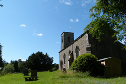
The church is of rubble walling, with a north aisle. The nave and chancel S wall appears to be of one build, the north arcade with clerestory is late Perp with rather crude capitals. There is a chapel in the angle between north aisle and chancel which appears to be of a later build.
A restoration of the church is documented in 1734 from when the W tower dates. In 1862 the church was re-medievalised through the reintroduction of Dec tracery into the S aisle, a three-light Perp E window, and cusped Perp tracery in N aisle. The only Romanesque feature is the S doorway.
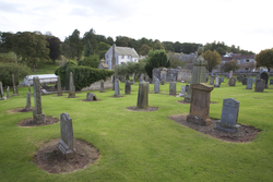
Ruined parish church
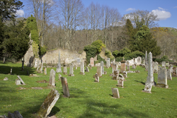
The ruined church is composed of two compartments, the eastern one used as a burial enclosure. Built into one of the S nave windows is a reused decorated stone fragment, and in the adjoining churchyard there is a coped, tegulated grave cover. After the Reformation, the barony of Ancrum passed first to the Duke of Richmond and Lennox, and later to the Earl of Roxburgh. Towards the end of the 17thc, the parishes of Longnewton and Ancrum were annexed. At one time there were two villages, Over and Nether Ancrum. Both were burned during the English attacks of 1544-5. The church was rebuilt in 1761-1762 and further work undertaken in 1831-1832. It was finally replaced with a church newly built near the village green in the late 19thc. After this the old church was reduced to form a romantic ruin for William Scott of Ancrum. After the Reformation, the barony of Ancrum passed first to the Duke of Richmond and Lennox, and later to the Earl of Roxburgh.
Ruined parish church
The medieval church does not survive, but some ashlar may have been reused in the construction of a burial vault on the site. In 1627, the church was described as in a ruinous state, the roof already decayed. Certain repairs were made in 1669, but in 1688 a report noted further faults with the roof. In 1750, it was finally decided to unite the parish of Kirknewton with that of East Calder, following which a new church was built on an entirely different site. In 1780, much of the church appears to have been demolished, and in 1844 it was reported that there were ‘scanty remains’ on the site of the old church. Until the 1950s/60s, a hogback type grave cover was to be seen in the churchyard, S of the ruins. It has since disappeared, but a photograph and various descriptions survive.
Ruined parish church
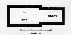
The Wheel Kirk was sited beside the Wheel Causeway in Liddesdale. Although the church and village have long disappeared, in 1914 excavations were carried out on the site of the church, when various carved stones and the foundations of the church were unearthed. The excavations showed a two-celled church with a rectangular nave and narrower, rectangular chancel. It is uncertain when the church was abandoned, but it appears to have occurred after the Reformation. In 1600 the 'Quheill' Church in Liddesdale is mentioned as 'waist' and valued at £10. On 9 December 1604, the Wheel Kirk was united to Castleton. The church was still marked on Blaue's map in 1648, but by the mid-19thc nothing survived above ground.
Parish church
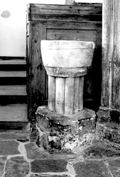
Brixton Deverill is a small village 4 miles S of Warminster. The church has a 13thc chancel arch and a short W tower of the 13thc and 15thc. The only Romanesque carving is the font that was brought from Imber Church when that village became a military training ground in the Second World War.
Parish church
There have been numerous changes to the church. Repairs were undertaken in 1616, but in 1754 the chancel was shortened. Then, in 1774, after the collapse of the W gable, the nave was shortened. In 1784 further work on the church was carried out and still more in 1813. New windows and a new porch were constructed in 1857-8, at which time, the medieval tympanum was moved from its position over the S nave doorway to the outer arch of the new porch. Finally, in 1910-12 the chancel was rebuilt and other work carried out.
Parish church
Lydiard Millicent is a village about 3.5 miles W of Swindon. The name Lydiard may derive from the Old English word meaning 'gate by the ford' and the complete name is first recorded in 1268 (Lydyerd Mylisent, see History). All Saints church lies to the NW of the village and was possibly built on the site of a pre-Norman church. The present building dates from the 14th and 15thc and consists of a chancel, nave, N and S aisles, and S porch; the W vestry was added in 1924. However, the font probably dates from the late 12thc.
Parish church
The church originally comprised a 13thc. nave, chancel and W tower, Modifications were carried out to the nave in the 15thc and 16thc and the S aisle, S porch and vestry (abutting the chancel) were added at this time. The font is the only 12thc. feature and is believed to have come from the church of St Martin, Martinhoe, having been found in the garden of the Rector of Martinhoe (Bulner-Thomas 1995, 3).
