The Corpus of ROMANESQUE SCULPTURE in Britain & Ireland

St John the Evangelist (now)
Chapel
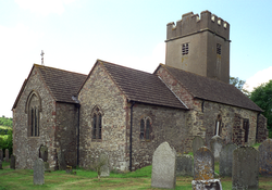
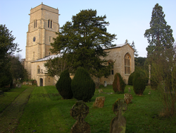
The church is of rubble walling, with a north aisle. The nave and chancel S wall appears to be of one build, the north arcade with clerestory is late Perp with rather crude capitals. There is a chapel in the angle between north aisle and chancel which appears to be of a later build.
A restoration of the church is documented in 1734 from when the W tower dates. In 1862 the church was re-medievalised through the reintroduction of Dec tracery into the S aisle, a three-light Perp E window, and cusped Perp tracery in N aisle. The only Romanesque feature is the S doorway.
Parish church
Lockerley is in W central Hampshire, five miles NW of Romsey and two miles from the Wiltshire border. The river Dun, a tributary of the Test, runs SE to the N and E of the church, and sheep are pastured in the fields nearby. Lockerley has no village centre, but consists of houses along the road from East Tytherley, a mile to the N. The church is at the S end of this road, with Lockerley Hall a mile to the N, closer to East Tytherley.
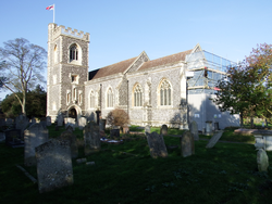
The present church was built by Colson in 1889-90 in grey rough-dressed ashlar with yellowish ashlar dressings in a mixture of styles with 14thc and 15thc details. It consists of a nave with a SW tower incorporating a porch; N and S transepts and a chancel with a N vestry. The tower has an ashlar broach spire, and the N transept now houses the organ. In the W wall of the S transept is a plain, tiny round-headed lancet with a continuous rebate on the outer face. It formerly stood in the churchyard, and must have come from a 12thc church. The only Romanesque sculpture recorded here is a plain cylindrical font bowl now in the S porch.
Parish church
Low Crosby is a village on the river Eden, about 6km NE of Carlisle. Hadrian’s Wall runs through the northern part of the parish. The medieval church of St John was rebuilt in 1854, but little is known about the previous medieval building. Preserved inside the church is a Romanesque baptismal font. Low Crosby and High Crosby jointly form the historical parish of Crosby-on-Eden.
Parish church
The 12thc church no longer survives. The present church was built c.1849, a little to the north of the site of the medieval one. It comprises a chancel with S chapel, a nave and N porch.
Parish church
Elkstone village is situated at one of the highest points in the Cotswolds. It is located off the A417 between Gloucester (10 miles to the north-west) and Cirencester (8 miles to the south-east). There is an abundant supply of Great Oolite and Inferior Oolite limestone in the locality, with the remains of a quarry less than 1000 metres south-west of the church (Herbert, 1981, 210).
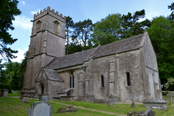
Elkstone church is one of the Romanesque architectural jewels of the Cotswolds. It is constructed of coursed rubble and ashlar, presumably quarried from the local area. The structure comprises a square-ended sanctuary, chancel, aisleless nave, west tower and south porch. 13thc additions include the chamber/dovecote above the east end and the windows in the south walls of the chancel and sanctuary. New windows were inserted into the nave and north wall of the sanctuary in the 14thc. The W tower dates from the 15thc (Herbert, 1981: 217-8).
The most important 12thc survivals are the south nave doorway, the chancel and sanctuary arches and vaults, and the corbel table. Some carved fragments have also been reused as masonry in various parts of the church, including the 13thc dovecote.
Parish church
Folkton village is at the foot of the Wolds looking north across the vale of Pickering towards Scarborough and the coast. The church has a broad plain W tower, nave and chancel. The N wall of the nave and chancel are continuous (compare Etton). In about 1771, the nave was reduced in width by (it is said) 10 feet on the S side. An old roof line of the nave, seen on the E wall of the tower is to the N of the present apex. The chancel was shortened ‘by half’ in 1772. In the 1890s work concerning the tower was done, and windows in the S wall were updated (Robinson, after 1999, 3-4; see also Borthwick Institute Faculty 1892/26 where there is a plan).
Romanesque remains are the blocked N doorway and a length of string course on the N wall; the jambs and capitals of the chancel arch; a font and a loose corbel.
Parish church
Havering-atte-Bower is now an outlying village in the London borough of Havering, 3 miles N of Romford. The church of St John in the village centre was built by Basil Champneys on the site of the demolished medieval chapel of St Mary. St Mary's was demolished in 1876 and St John's was dedicated 2 years later. Champneys's church consists of a chancel with a N organ room and vestry, a nave with a 3-bay N aisle, and an embattled tower with a SW turret, sited on the S side of the nave at its W end. The building, in the Decorated style, is of brick faced with flint. The only Romanesque feature is the font from the old church.
Parish church
Cutcombe is an Exmoor village in the W of the county, consisting of houses and farm buildings and the church along a lane in hilly country overlooking the Avill valley. It is these days effectively eclipsed by the adjacent settlement at Wheddon Cross, which has obviously developed around the crossroads of the A396 Dunster-Exeter main road and the B3224, a very important secondary route running along watersheds across the Brendon Hills and Exmoor — linking the Taunton area with the west end of Exmoor (for access to Lynton, Ilfracombe, Barnstaple, etc.). The A396 divides the Brendon Hills from Exmoor proper, so Cutcombe is just within the former area (although within the Exmoor National Park). The church is perched above a steep valley gouged by a tributary of the Avill which has its source closeby. There are also nearby springs. All of which accounts for the settlement. (The Avill is near the village but not relevant to its heart.) At 300m, Cutcombe/Wheddon Cross is known for being the highest village on Exmoor.
The A396 takes a N-S route, taking advantage of the north-flowing Avill and its tributaries, up to the high pass at Wheddon Cross, the narrowest point of the W-E watershed, whence it descends rapidly into the valley of the south-flowing Quarme and its tributaries. Approximately three miles S of Wheddon Cross the Quarme flows into the major Somerset/Devon river Exe. The A396 continues down the Exe valley to Exeter.
The church was recorded in 1791 with a dedication to St Lawrence, but by 1830 the present dedication was established. The 13thc – 14thc church has an aisled nave with a S porch, a chancel with a S chapel and a W tower. Construction is of random rubble, and there was a restoration from 1862. The only Romanesque feature is the font.
Parish church
The square W tower of Wicken church was erected by Robert, Lord Spencer
in 1617, but the remainder of the medieval building was taken down in 1753,
after it was found to be unsafe. The cost of rebuilding was met by Thomas
Prowse, described as the designer of the church on a tablet in the N aisle. It
was completed by 1770, and comprises a nave with aisles of equal height, N and
S transepts and a square chancel. The church was
restored in 1838, and again by Matthew Holding in 1896-97. In the latter
restoration the chancel was lengthened to the E, the S
transept was added, and a boiler-room built at the W end of the N aisle. The
12thc. font may be the sole relic of an earlier structure on the
site.
Parish church
Pauntley is in the Leadon valley in N Gloucestershire, immediately S of the Malvern Hills and 10 miles W of Tewkesbury. The parish is centred on the church and Pauntley Court; beyond this settlement is dispersed. The church has a Norman chancel (the E window splay survives) with a S chapel, a 12thc nave with a N porch, and a W tower. Romanesque sculpture by the Dymock School sculptors is found on the S doorway and the chancel arch.
