The Corpus of ROMANESQUE SCULPTURE in Britain & Ireland

St Peter and St Paul (now)
Parish church
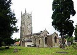
The village of Kilmersdon lies at the head of a valley leading N through the Mendip Hills to Radstock. It straddles the secondary road between Norton St Philip and Chilcompton, which road climbs to the W of the village up to the ridge along which runs N-S the Fosse Way and, to the NE, around Ammerdown Park up to the ridge along which runs the Frome-Radstock main A362 road.
The church is of Norman origin, although much of the existing fabric dates between the 15th and the 16thc; the church was restored in the 19thc. It consists of a W tower, a nave, a chancel, a N aisle with a chapel, a S organ loft and a vestry. The Romanesque elements comprise the window in the nave S wall (reopened in 1898), the plain narrow S doorway (now into the vestry) visible from the nave, remains of a chancel N window (again visible only from inside), many stretches of a fish-scale frieze outside, part of a corbel table on the nave walls and built-in fragments of carving inside (chancel N wall) as well as outside.
Parish church
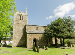
Owmby-by-Spital is a village in the West Lindsey district of Lincolnshire, 11 miles N of Lincoln and 8 miles W of Market Rasen. The church is on the S side of the main road though the village and is a limestone rubble building with ashlar banding. It comprises a W tower, a nave with N aisle and a chancel. Romanesque sculpture is found in the N nave arcade.
Redundant parish church
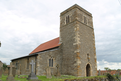
Normanby by Spital is a village in the West Lindsey district of the county, 7 miles W of Market Rasen and 10 miles N of Lincoln. The church stands at the crossroads in the centre of the village and consists of a W tower, aisled nave and chancel. The tower is 12thc in origin with a weathered chevron stringcourse and two carved Romanesque voussoirs reset into its exterior S and W walls. The belfry lights are 13thc and 14thc and there is a battlemented parapet. The nave has a fine Romanesque N arcade, and the S aisle was rebuilt in 1890.
The church is now in the care of the Churches Conservation Trust.
Parish church
North Curry is a village 5 miles E of Taunton. The village straddles and straggles along a low Mercia Mudstone ridge extending over the low moors NE of Taunton terminated by the River Parrett at Stathe. It lies just S of the River Tone at about 25m OD, and 8km E of Taunton. North Curry, like Stoke St Gregory, is one of the two largest villages, both of which are blessed with parish churches. Although a road runs along the ridge, it is not now more than locally important.
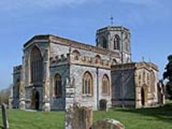
The church of St Peter and Paul, sometimes known as 'Cathedral of the Moors' stands to the N of the village centre on the crest of the scarp, and commands a fine prospect across the low moors. The striking edifice can be very clearly seen from afar to the north, and its builders through the ages may well have been conscious of it making a strong statement on the landscape. Its building development suggests that there was no shortage of resources, particularly around 1300 and 1500 by which time the church had been largely rebuilt. The N doorway is Romanesque.
Parish church
Borden is a village 2 miles SW of Sittingbourne. The church of St Peter and Paul has aisled nave and chancel, a solid W tower and a S porch. Features of interest include the W doorway and the tower arch.
Parish church
Worth is a village about 1.5 miles S of Sandwich. The church of St Peter and Paul consists of a nave with a S aisle, a chancel with adjoining chapels, a W tower with a spire, and a N porch. It was subject to a restoration in 1888, which may be the explanation for the large amount of modern replacement material present. Romanesque sculpture includes the N doorway, the S nave aisle, and a re-set fragment in the S aisle.
Parish church
Shepton Mallet is a small town in Somerset. It lies towards the head of the river Sheppey which runs roughly W towards Wells, 5mi distant. Although therefore in a valley, it is quite high up (mostly between 100m and 150m above OD) and near the S edge of the Mendip Hills.
The church of Sts. Peter and Paul is a complex, compact building of several medieval periods and with much 19thc work. Plans of the church in the years 1835/7 (available online via Lambeth Palace library) show an aisled rectangular nave of four bays, W tower, and a tiny one-bay chancel and N vestry which probably disappeared in 1847. The arcades appear to preserve some original trumpet capitals, but there are also signs of later medieval alterations and 19thc copying. As well as the work in the arcades, there is a plain font and a loose fragment which may be relevant to the Corpus.
Parish church
Caistor is a small town in the West Lindsey district, 11 miles W of the coast at Grimsby and 15 miles SE of Scunthorpe. As its name suggests it was a Roman camp and parts of the Roman walls survive. The church is in the centre of the town, on the site of the Castrum. It consists of a W tower, 11thc in origin; a nave with 11thc work at the W end but with later additions including 13thc N and S aisles, and a 15thc clerestorey; a 13thc S transept; and a chancel rebuilt in 1848, with a 13thc chancel arch and N and S chapels with 13thc entrance arches. The W tower has an early Romanesque W doorway. The church was restored by Butterfield in 1862.
Parish church
Dymchurch is a seaside village 5 miles SW of Hythe on the Channel coast. The church of St Peter and Paul is situated by the main coast road and is much-restored; the building consists of a nave with a N aisle, a chancel, a S porch, and a slim W tower. Although relatively unassuming from the outside, and presenting a late medieval appearance, there are Romanesque W and S doorways, and also a Romanesque chancel arch. A further dooway in the chancel is mentioned by Glynne who visited in 1868, but it went lost.
Parish church
Broadwell is a village about nine miles W of Witney. The church lies to the N of the village and was built around 1190 of coursed rubble limestone (Sherwood and Pevsner (1974), 488-9). The church originally consisted of a chancel, a presbytery bay, a nave and a W tower. In the 13thc the whole building was remodelled: the chancel and the presbytery were united to form an enlarged chancel, new windows and buttresses were added to the chancel and tower, and the N and S chapels were built. The church was extensively restored in 1873 by Edward George Bruton. The surviving Romanesque features are the nave N and S doorways, the E tower arch and the Transitional, or possibly later, font located at the W end of the nave.
