The Corpus of ROMANESQUE SCULPTURE in Britain & Ireland

Bath and North East Somerset (now)
Parish church
The reader is referred to the report on the church of St Martin at North Stoke for important general material on this area, part of Mercia during the Saxon period.
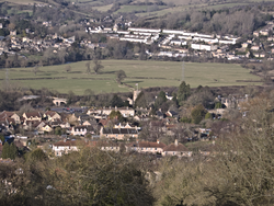
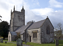
The view showing Bathampton church in its landscape-setting looks across from the church to the water-meadows south of the Avon to the housing-estates of Batheaston on the other side of the river. The first bridge left of the church carries Mill Lane between Bathampton village and Bathampton Bridge (and Batheaston beyond) across the main railway line; the second (clearly more recent) bridge carries the lane over the newly aligned A4.
Bathampton and Batheaston, nowadays virtually suburbs of Bath, lie on opposite sides of the Avon (on the left and right banks, respectively) at the point where the river turns its course from north-westerly to south-westerly, flowing around the massif of Bathampton Down to its south — which hill rises to 204m above OD and thus makes a dramatic statement south of the river in a landscape otherwise characterised by north-south Cotswold ridges reaching down to end on the north side of the Avon valley. The Down, which shows ample evidence of exploitation in prehistory and later — Wansdyke, probable frontier between Wessex and Mercia, runs across the top — , is nowadays privileged by the site of a fine golf course which incidentally rewards the walker with exceptionally instructive as well as beautiful views.
Perhaps the clue to the siting of Bathampton is that the first river crossing above Bath itself (which may reflect a long-standing historical reality) is just north of the church — now effected by a fine bridge with attendant mill. The lane from Bathampton Bridge which runs past the west end of the churchyard would originally have continued south up to Bathampton Down, so one suspects here an important medieval and pre-medieval route. Nowadays, that route is very much cut across and obscured by later developments: (1) the Kennet & Avon Canal runs roughly east-west parallel to the south side of the churchyard little more than a lane-width away (and slightly elevated), the bridge carrying the present lane across the canal being about 100m west of its presumed original line; (2) the development of the village between the canal and the main A36 Bath-Southampton road which runs around Bathampton Down above most of the settlement. Housing development is predominantly orientated on that main road; it appears on the 1904 second edition OS six-inch map, based on an 1882-3 survey revised in 1902, to have been strung out along the A36 between Bath and Bathampton at least since the end of the nineteenth century.
A very recent development in road-building has resulted in yet another main road along the busy Bathampton corridor: the main A4 London to Bristol road, which used to run through Batheaston, has been provided with a by-pass (which makes a very easy connection — if of rather questionable æsthetic effect when viewed from certain points, e.g., Bathampton Down — with the A46 running north to the M4). Like the railway alongside, this runs past Bathampton through a cutting.
Archæological investigations attending the building of the new road in the water-meadow area between the river and the gravel terrace occupied by the most northerly part of the village discovered, as to be expected, evidence of exploitation from the Iron Age to the Middle Ages through the Roman and sub-Roman periods.
The remaining means of communication to take into account, Brunel’s main railway line to Bristol from Paddington via Chippenham and through the fine Box tunnel c.5kms east, is crammed into the small space south of the river as it passes Bathampton but, although only about 50m north of the churchyard, it runs through a cutting and is thus relatively unobtrusive. Once upon a time there was a station for Bathampton (just north-east of the church) but of course modern conditions have rendered that awkward as well as unnecessary. South to north, the canal is 500m from the main A36 road, the railway 150m from the canal, and the new A4 road about 25m from the railway — the church being squeezed between canal and railway.
Nowadays, the canal is much used for leisure (although there seem to be some permanent residents), its towpath is a fine walkway, the George pub opposite the church is very well patronised, Walter Sickert rests in the churchyard: consequently, this particular spot is often a scene of picturesque and happy activity, especially but not exclusively in fine weather.
Geologically, Bathampton is built on a gravel terrace created by the river Avon.
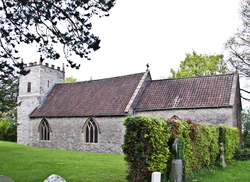
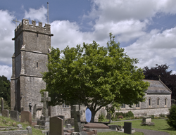
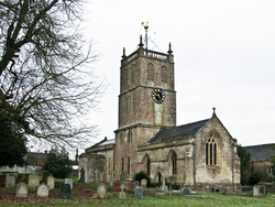
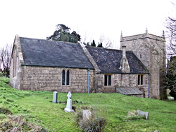
The church is 13thc in origin and consists of a W tower, nave, N and S aisles, S porch and chancel. The tower is 15thc, and the N aisle was added in 1858. The chancel was restored in 1882. There was an earlier restoration by Ralph Allen in the mid-18thc, but evidence of that was largely obliterated by later works. Construction is of ahlar and coursed squared rubble.
Parish church
East Harptree is a village in the upper Chew valley, now in the Unitary Authority of Bath and North East Somerset. The valley yields terrain conducive to settlement and road communication. There are easy routes through the hills W, E and N; routes S over Mendip (to the diocesan centre of Wells, for example) are not so easy but perfectly feasible. That the place-names probably refer to the local herepath corroborates the sense of relatively easy road communications in the area; the second element of ‘Harptree’ refers to woodland. East Harptree straddles a lane which runs SSW from the West Harptree-Chewton Mendip secondary road and climbs Mendip to meet a principal N-S route across the high ground (West Harptree to Wells). The principal road of the valley, running through West Harptree, is the A368 connecting Bath with Weston-super-Mare. Bristol city centre is about 10 miles N as the crow flies.
The village, at about 110m above OD on the gradual N slope of Mendip, on Dolomitic Conglomerate bedrock above Mercia Mudstone (formerly called Keuper Marl), commands a good view of the Chew valley running N. The river is about 1 mile NE of the village. As well as pastoral farming, the economy of the locality formerly incorporated mining activities (on Mendip).
The church is in the village centre and consists of a chancel, a nave with a N aisle and S porch and a W tower. Construction is of coursed sandstone and limestone rubble to the tower and south porch, squared and coursed rubble stone to the nave and chancel, and dressed stone openings, quoins and copings. The earliest parts are 12thc, but there is 13thc work too and the tower is 15thc. The church was restored on the late-19thc. Features described here are the transitional S doorway, a lone corbel and the remains of a stringcourse on the S chancel wall, the font and carved stones reset in the churchyard wall.
Parish church
The parish of Bathford is long (c. 7kms) and narrow (averaging c. 1km), and sandwiched between the river Avon and the Wiltshire border, on the E outskirts of Bath. It is divided into two parts by the By Brook which runs into the Avon just upstream from Batheaston, N of Bathford village; strategically occupying the broad dip at the N end of the NS ridge of Limestone which is interrupted by By Brook. Geologically, the bedrock on which the environs of Bathford rest is essentially limestone but, as in the whole of this area (apart from the Oolitic limestone upland plateaux) the bedrock geology is basically Lower and Middle Jurassic. Quarries to exploit the limestone were situated above Bathford and must have played a major economic role in the past.
The village itself commands the confluence and the crossing of the Avon by the highway between Bath and London (now the A4), and the church is on the W edge of the village, nearest the river Avon. It has a chancel with N and S chapels, a nave and a S aisle of 1870-72, and a N aisle and porch of 1856. The W tower dates from 1879-80.
Romanesque features are the N doorway (heavily restored), various fragments attached to the external E wall of the N aisle, and loose stones at the E end of the churchyard. The font is probably 13thc, but is described as it includes some Romanesque characteristics.
Parish church
The tiny hamlet of Chelwood, in the Mendip Hills south of Bristol (the church is at an altitude of c.90m above OD), is just half a mile east of the crossroads of the main A368 between Bath (8 miles distant) and Weston-super-Mare, running east-west through it and the main A37 road between Bristol and the English Channel coast. It thus enjoys easy road communications.
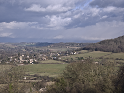
The distant view from the south-west of the hamlet from the main A37 near the top of Red Hill (174m), brings out the rural landscape seen as one looks slantwise across a gentle north-facing slope predominantly pastoral with some considerable woodland towards the southern flanks of the Cotswolds north-west of Bath across the river Avon. The meaning of the place-name has nothing to do with a wood: it signifies ‘Ceola’s or Ceolla’s worþ’, ‘worth’ meaning ‘enclosure’.
The church of St Leonard, which is built of sandstone and limestone rubble with limestone dressings, consists of a W tower, nave, N porch, S aisle, chancel and S vestry. Constructed in the 14thc., it was almost entirely rebuilt c.1860. The only Romanesque feature is the font.
Parish church
Saltford extends westwards from the L bank of the Avon between Bath and Keynsham (4 miles from the former and 2 miles from the latter), on either side of the main A4 between Bristol and Bath. The church is at the N edge of the village only 300m from the river, accompanied by the manor house dating from the Norman period and reputably the oldest habitation in the country. Geologically, Saltford exploits (like many settlements in this area of N Somerset) an unusually large area of limestone bedrock: specifically Blue and White Lias of the Lower Lias division of Jurassic rock. The place-name signifies ‘salty=tidal ford’ although various weirs now prevent the river being so up to this point. Saltford’s relatively low-lying position in the Avon valley alone must have occasioned considerable traffic and exploitation of resources; further, communication from the R bank which gave access to the Roman road running north of the Avon between Bath and the port at Sea Mills (W of Bristol) would have enhanced its utility.
The church is of 12thc or possibly Saxon origin, with some mid 17thc rebuilding following Civil War damage in 1643. It was restored and remodelled in 1832, with much of the walling rebuilt on earlier foundations. The font might have 12thc origins but has been remodelled.
Parish church
Radstock is a small, former colliery town 7 miles SW of Bath. The town lies in and among the deep valleys of the NE Mendips: quite a dramatic landscape and not without fields even now that the conurbation of Radstock with Midsomer Norton has mushroomed with dwellings. It owes its name to its important position, at the crossing of the Wellow Brook, on the Fosse Way — or, rather where the present A367 (choosing easier gradients than its Roman ancestor) crosses it, the Fosse Way itself having taken a more precipitous line 1km to the W. Pevsner’s (1958) comments on the town are worth quoting at length:
‘Radstock is really desperately ugly. Or so at least it appears in its pleasant countryside. In industrial counties one would perhaps praise the nearness of field and hedgerow and the hilly site as such. In Somerset the small colliery town without dignity in any building hurts particularly.’
The collieries have now of course long been closed, but there are still probably few buildings of much merit.
Communications are good but exclusively by roads now that the railways have gone. (Radstock was once connected to Bath and Shepton Mallet by the Somerset & Dorset Joint Railway, and to Frome and Bristol by the Great Western Railway.) The geology, above the coal measures, valley Alluvium and landslip, consists of Mercia Mudstone and a narrow band of Cotham Member and Westbury Formation Mudstone (on which the church sits) below what is essentially the Blue Lias of the hills to the NW and SW of Radstock (which rise to slightly over 150m OD).
The church itself lies a merciful 300m S of the town’s busy central crossroads, on the left bank of the stream, at an altitude of about 72m OD; reaching it from the S, one has little awareness of the town: on a sunny day, it almost seems pastoral!
It consists of a 3-bay chancel with a N vestry, a 5-bay nave with a N aisle and a S porch, and a W tower. Of this, the W tower is 15thc, and possibly also the S wall of the nave and the porch, The rest was rebuilt in a Geometric gothic style in 1879. Construction is of coursed limestone rubble with weathered buttresses. The only Romanesque feature is the font.
Parish church
Priston is a village 4mi SW of Bath in NE Somerset. Much of the parish has a certain remoteness which is due to the hilly, sparsely populated terrain and access being only by lanes. It will be seen from the distant view of the village that it nestles in a shallow combe: this valley is watered by Newton Brook which flows into the Avon near Twerton, just downstream from Bath. Geologically, like so many settlements in this area, Priston village lies on Lower Jurassic rock — specifically, a narrow exposure of Blue and White Lias (limestone) surrounded by the clay of Lower Lias. Much of the parish is above 100m above OD but rises to over 150m. The church itself, slightly above the village and about 200m from the very centre of it, is at an altitude of about 90m. The Grade 1 listed church of St Luke and St Andrew is made of rubble with freestone dressings, and some ashlar. It has a nave, north vestry, central tower, and chancel. The church has 12thc origins, with probably a 14thc phase, and the tower was rebuilt in the 1750s. There was a major restoration in largely neo-Norman style in 1861, which included the arches under the tower (see Comments). There is a Romanesque corbel table, south doorway and a piece of loose sculpture.
Parish church
North Stoke, Somerset (not to be confused with North Stoke, Sussex and Oxfordshire) is a small village in NE Somerset; in 2010 it had only 72 inhabitants. Relatively insignificant though it certainly is in respect of Romanesque sculpture, St Martin’s deserves close consideration for its strategic location. It is sited 4 mi NW of Bath at the top of a tiny nucleated settlement perched up on the NW flank of Lansdown Hill, thus enjoying an extensive and commanding view of the Avon valley and across to the Welsh hills.
The church of St Martin has a sturdy but squat W tower, nave, and a chancel which is of similar dimensions to the nave. A major restoration took place in 1888 which repaired or replaced much of the fabric. Much of the building is from the 13thc. to 16thc. although the W tower dates from the 12thc. The font is also Romanesque and there is reused sculptured masonry in the nave walls which may date from the 12thc.
Parish church
The place-name is ‘Hantone’ in the Domesday Survey (i.e., ‘tun on the high ground’), ‘Charterhouse’ being added some time after the 1232 foundation of the nearby Charterhouse of Locus Dei by the widow of William Longespee. The Priory ruins are about 800m N of the church. Both the priory and the secular settlement occupy a prime level position on the plateau of Forest Marble at the NE extremity of the Mendip Hills. Hinton Charterhouse church lies at an altitude of 135m OD above the L bank of the River Frome, 1.5km distant to the NE (the Frome joins the Avon less than 2.5km to the NE). The extremely busy A36 trunk road linking Bath with Salisbury and Southampton runs 700m to the E; a route which must be ancient. The village itself straddles the B3110 between Norton St Philip and Bath via Midford. The church is adjacent to Hinton House, built at the beginning of the 18thc on the site, it is thought, of a monastic grange.
The church consists of a chancel, nave with S chapel and porch, and N aisle. and a W tower. The oldest parts, including a S doorway, are 12thc. The tower dates from the late-12thc or early-13thc and was restored in 1770. The N aisle was added in 1825 and restored in 1846. Construction is of rubble and coursed rubble with freestone dressings. Romanesque work is found on the S doorway and the font.
Parish church
As suggested by the place-name, Hinton Blewett is on high ground — specifically, at an altitude of about 150m above OD on the N side of the upper Chew valley. Its local stream, the Cam Brook, rises nearby and runs NE parallel to the small village on its SE side. The bedrock here is Triassic Blue/White Lias above Mercia Mudstone (formerly called Keuper Marl) — the Lias outcrops forming a large ring around coal measures. The village is only reachable by lanes: its remoteness paradoxical for a location within 15kms of Bristol city centre but typical of the settlements in this hilly area between the Avon and Mendip. Access to the outer world is by the secondary road linking West Harptree (A368) with Chewton Mendip (A39) or by the A37 (at Temple Cloud via Cameley, 3kms E).
The church is on the N side of the village centre and consists of a chancel, nave with N aisle and S porch and a W tower. Construction is of squared and coursed rubble in the nave and porch and random rubble in the tower, all with ashlar dressings. The church is largely of the 13thc with the aisle added in 1553 and the tower rebuilt in the 1780s. There was a restoration in 1928.
