The Corpus of ROMANESQUE SCULPTURE in Britain & Ireland

Windsor and Maidenhead (now)
Chapel, former
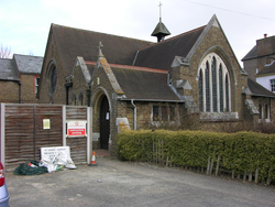
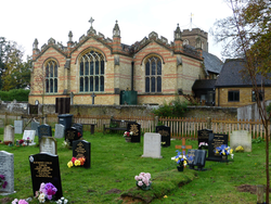
Spital is on the southern edge of the town, and the northern edge of Windsor Great Park. The chapel stands on St Leonard’s Road and was built in yellow brick in 1874. It consists of a nave with a W gallery, a Lady Chapel, added as a S aisle, and a S porch at the W end of the S aisle. In its present use as a Music Centre, the weekly service is held in the Lady Chapel, while the main altar has been removed and replaced by a grand piano. The only Romanesque sculpture here is the 12thc font.
Parish church
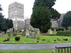
Large church of 14thc. and later, extensively restored 1859-60. In the churchyard N of the church a flint building, originally the Chantry Chapel of St Mary, later a school called St Michael's Hall. In the S wall of this is a reset 11thc. or 12thc. relief.
Parish church
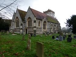
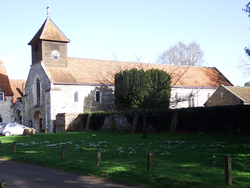
The fabric of the church was entirely replaced in restorations of 1849, 1856 and 1878, apart from the late 16thc. Hoby chapel S of the chancel and the 12thc. W tower. Late 12thc. sculpture is found on the E arch of the tower and the bell-openings (the latter restored in 1962).
Parish church
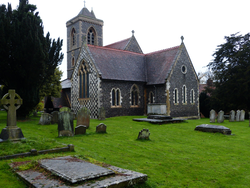
White Waltham is a village 3 miles SW of Maidenhead in wooded farmland. Waltham Place and its grounds lie on the eastern edge of the village, and Shottesbrooke Park on the west, giving the area a lfeeling of parkland. The church is in the centre of the village and has an aisled nave, S transept and chancel, all 13thc. or later. In 1868-69 the majority of the church, except the chancel, was rebuilt by G. E. Street, and a W tower added, and in 1889 a N transept was built. Inside, the E and S tower arches are reused structures of c.1100, the E arch plain and the S carved. The S doorway includes two reused 12thc. capitals.
Parish church
Waltham St Lawrence is a small village in wooded farmland 4 miles SW of Maidenhead and 8 miles NE of Reading. The church stands in the centre of the village, and comprises a two-bay 12thc. aisled nave extended to the E by two Dec bays, and a W tower,and a chancel with N and S chapels all c.1300 or later. The nave has a S porch, and the N chapel a modern N vestry. Romanesque sculpture is found in the 12thc nave arcade capitals.
Parish church
In 1868 Clewer was described as a parish a mile from Windsor, but today it has been almost entirely subsumed by its neighbour. Clewer is at the northern extremity of Windsor, alongside the Thames, whose floodplain has effectively put a stop to expansion in that direction. St Andrew's is a flint church with a short W tower carrying a shingled broach spire. Otherwise it has a chancel with a S chapel, a nave with N and S aisles, the N continuing eastwards as a chapel, now used as an organ loft, and vestry, and a modern S porch. The present S aisle was the original, early 12thc. nave of the church, and its plain chancel arch now leads to the Brocas chapel; the old chancel rebuilt as a chantry by Sir Bernard Brocas in the 14thc. The present nave was added in the later 12thc., and the three-bay S arcade dates from that time. The present N arcade appears to be of the early 13thc., but there is a record of "a new N aisle with wall repairs" added by Henry Woodyer in 1861. Woodyer may thus have widened an existing aisle. The chancel was also restored by Henry Woodyer in 1868. The plain 12thc. chancel arch is round-headed, of one order with plain hollow-chamfered imposts. Romanesque sculpture is found on the S nave arcade and the font.
Parish church
Sunninghill is in the extreme SE of Berkshire, 4 miles E of Bracknell and 1½ miles N of the Surrey border. The Roman road to Calleva (Silchester) runs a mile south of the village. It is on the SW edge of Windsor Great Park, and is characterised by large houses and parks like its neighbours of Sunningdale and Ascot. The church stands at the northern edge of the village, and is largely a rebuild by Richard Hayter and James Pither of 1826. The 12thc W doorway of the former church was recovered from a demolished house in 1926 and incorporated into the 1826 church (see Tyack (2010). The present church has a 4 bay nave; north and south aisles; a west tower with a porch beneath; and a 2-bay chancel with north vestry and south chapel. On the north side of the church is a parish room extension, linked to the vestry.
Castle
Windsor Castle, founded by King William I, consists of a big chalk motte on which stands a round tower, with walled enclosures to the W (the Lower Ward) and E (the Upper Ward. This is no place for a full architectural description of the castle, especially since it is by no means certain that the carved Romanesque stones described here were originally from this site (see Comments and Opinions, below), but the Bibliography will be useful as a guide to further reading about the site.
The material described here is all in the form of loose or reset stones, out of context and displayed in various locations around the castle, as follows.
The Moat Garden
This is the cultivated motte on which the Round Tower stands. The earliest account we have of a garden on the mound is in King James I of Scotland’s poem,The King’s Quair, written during his period of captivity at Windsor Castle between 1413 and 1423. This describes a small and private garden alongside the wall of the Round Tower :
Now was there maid, fast by the Touris wall,
A gardyn faire, and in the corneris set,
Ane herbere grene, with wandis long and small,
Railit about, and so with treis set
Was all the place, and hawthorn hegis knet,
That lyf was non, walkyng there forbye,
That mycht within scarce any wight aspy. (Tighe and Davies (1858), 79.)
There was little or no planting on the rest of the mound then, and none is visible in Norden’s 1607 view of the castle, but Hollar’s c.1672 engraving shows the south slopes divided into a series of geometric beds, quite unlike the present arrangement. (Roberts (1997), 161).
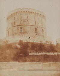
The area of the mound is associated with the so-called Norman Gate, built alongside it by William of Wykeham c.1359. At the time of Wyatville’s restoration of the castle, the mound had been rented out to a fruit and vegetable grower who sold the produce at market. The fruit trees planted against the curtain walls below the Round Tower were apparently undermining it, and in 1836 Wyatville sent a strongly-worded letter to the then resident of the Norman Gate, Lady Mary Fox, the State Housekeeper, warning her that if any more fruit trees were planted there was a danger of it collapsing. Indeed, some years earlier part of the wall had collapsed for this very reason, and repairs at a cost of £1500 were needed to repair the damage. (Taylor (1935)). By 1844, when the mound was photographed by Fox-Talbot, it was planted with a few shrubs and small trees, but there was no longer any evidence of systematic fruit-growing. The wall that partly encircles the mound on the inner side of the middle terrace was in place by that date (figure 1).
In 1901 the Norman Gate was given as a residence to the Right Hon. Sir Dighton Probyn, on his appointment as Keeper of the Privy Purse. Probyn had been a young officer during the Indian Mutiny, when he was awarded the VC and he rose to the rank of general before he entered the service of the Prince of Wales, later King Edward VII. It was Probyn who was responsible for clearing away the remains of the Victorian design, and he transformed the mound into a richly-planted and less formal garden. He brought brown Carstone from Norfolk to build a rock garden, and introduced a water and bog garden and the present scheme of walls, terraces, borders and architectural ornaments. As we shall see, this work was in progress when Keyser photographed the Romanesque stones c.1915. The garden was neglected during the remainder of the Great War, and many plants were lost in the drought of 1921, so that Lord Wigram, Probyn’s successor as occupant of the house, had to restore the garden and added rare plants from the Far East (Taylor (1935), 326-28).
The present design is more or less Probyn’s, and consists of an outer crescent following the inside of the lower moat wall with a long bed of shrubs and herbaceous plants that runs in a three-quarter circle from the NE to the SE of the mound (figure 2). On this wall is an arched feature made of Romanesque carved stones (figure 3), and other loose stones are placed on stone shelves built onto its inner face. The bed is bounded on the inside by a low brick retaining wall, and inside this the ground is terraced to provide a flat lawn enhanced by rose beds and a small pond, with a paved terrace at the east end. From the inner edge of the lawn the mound rises steeply to the base of the Round Tower curtain wall, some 90 or 100 feet above. The lower slopes are simply grassed except towards the E, where they are planted with shrubs and trees, and at the far northern end, where the rockery descends with a series of pools and a flight of steps from the rear entrance of the Norman Gate, now the Governor’s residence, to the level of the moat wall (figure 4). At the top is the Herbere pavilion, and below it the Corinthian Fountain (figure 5), both of which include Romanesque carvings described here. Partway up the mound, and concentric with the line of the lower moat wall at the bottom and the Round Tower curtain wall at the top is a narrow terrace now known as the middle terrace (figure 6), and another arched feature made up of Romanesque carved stones is set there, with further carved stones placed on a shelf at the east end of the terrace (figures 7, 8). Above the middle terrace, up to the curtain wall of the Round Tower, the planting is denser, though still informal. At the extreme east end of the garden, at the foot of the mound, are greenhouses. The slope rising behind them has been reinforced with ashlar blocks, and among them are several stones with roll-moulded edges that show traces of possible Romanesque carving (figure 9).
The South Bowe
The South Bowe is a blocked sally port on the south side of the Upper Ward of the castle. It appears to date from the thirteenth century, although there is little in the structure that is diagnostic of date. In the passage is a rough arch constructed largely of clunch but including, in its west jamb, two moulded stones and two chevron voussoirs (figure 10).
The Carronade wall
The carronade wall is the retaining wall of the central motte on the Upper Ward side. A single stone carved with two units of diapering is set into this, described as cat. 55. It was photographed by Tsang and drawn by Brian Kerr. (figure 11).
All stones are numbered and described; the organisation of the stones being based on the type of object rather than its location. Loose stones were all photographed separately, but this was not always possible for stones built into structures, most notably the two arched structures in the Moat Garden. In these cases stones were identified by their position within the structure, and photographic references to the figures in which they appear are included in the feature descriptions.
1. The Lower Moat Wall. This structure takes the form of an arch attached to the garden side of the lower moat wall at the west (figure 12). There are two non-Romanesque stones carved with human figures in the centre, and around them is an arch made up of twelve 12th-century stones. Each jamb is made up of three stones, the arch is of five voussoirs and a niche-head in the centre forms a pseudo- tympanum. In the catalogue these stones are identified as follows:
LM1 - LM 3. Left jamb, bottom to top.
LM 4 - LM 8. Voussoirs of arch, left to right.
LM 9 - LM 11. Right jamb, top to bottom.
LM 12. Niche-head “tympanum”.
2. The Middle Terrace. The main feature is a structure in the form of an arch at the west side of this terrace, supported on a capital (R) or an impost (L) (figure 13). Five voussoirs form the arch, and five sections of label of two different designs surround the arch. Under the arch is another niche head, and below this, forming the centrepiece framed by the arch, is a post-medieval lion’s head. In the catalogue these stones are identified as follows:
MT1 - MT5. Label stones, left to right
MT6. Left hand impost
MT7 - MT11. Stones of arch, left to right
MT12. Right hand capital
MT13. Niche-head “tympanum”
Parish church, formerly Benedictine house
Hurley is a village 3 miles NW of Maidenhead and 4 miles E of Henley-on-Thames. The church stands at the N end of the village, alongside the river. The present church is the long, narrow, aisleless nave of the priory church, with 11thc. proportions and plain 12thc. windows. The carved W and S doorways are in 12thc. style, but the former belongs partly and the latter entirely to Henry Hakewill's comprehensive restoration of 1852 as does the W window. To the N of the church stand the cloister and refectory, now a private house, the former containing two plain arches which appear to be c.1100 but are not regarded as medieval by VCH. Further 12thc. sculpture is found inside the two doorways.
