The Corpus of ROMANESQUE SCULPTURE in Britain & Ireland

St Swithun (now)
Parish church
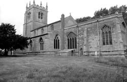
The proportion of the nave suggests that the nave may be Anglo-Saxon in date. The N arcade dates from the early or mid 12thc. while the S arcade of the late 12thc. was designed to follow its overall design but with more modern detailing. The font, with its lively naïve carving, also dates from the 12thc. In the first half of the 13thc. the chancel arch was built and in the 15thc. the nave was raised in height by the addition of the clerestory.
Parish church
The church consists of nave with side aisles, chancel, W tower, and S porch dating primarily from the 13thc. through the 15thc. centuries. Restoration of ceiling and chancel area undertaken in 1902-3. The S porch doorway has Romanesque nook shafts and capitals.
Parish church
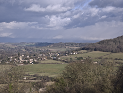
Clunbury is a small village in the SW of the county, on the edge of the Black Mountains., just 5 miles from the Welsh border. The village consists of a few houses and the church clustered around a crossroads at the foot of Clunbury Hill. The church is single-aisled, with a 12th. nave containing a 12thc. S doorway with carved capitals. There are remains of a second doorway further E: L jamb survives. There are two round-headed narrow windows on N and S sides of nave. A plain W doorway links nave and tower, with a plain, round-headed window above. The tower base is late 12thc., the upper levels later. The chancel has a round-headed 12thc. window on N side, now largely 19thc. A 12thc. font is situated at W end of nave L of the S doorway.
Parish church
Combe is in the far west of the county, in a spur of Berkshire that has borders with Wiltshire, half a mile to the west, and Hampshire, a mile to the south. The village is merely a few houses flanking a single track road that curves around the southern edge of Walbury Hill with its hillfort. The nearest town of any size is Hungerford, six miles to the north. The church consists of an aisleless nave, chancel and shingled W tower. The church is of flint, with chancel arch and S nave doorway of early 13thc., the latter with a brick porch dated 1652. The plain font is the only feature included here, although it probably dates from the early 13thc.
Parish church
The parish of Bathford is long (c. 7kms) and narrow (averaging c. 1km), and sandwiched between the river Avon and the Wiltshire border, on the E outskirts of Bath. It is divided into two parts by the By Brook which runs into the Avon just upstream from Batheaston, N of Bathford village; strategically occupying the broad dip at the N end of the NS ridge of Limestone which is interrupted by By Brook. Geologically, the bedrock on which the environs of Bathford rest is essentially limestone but, as in the whole of this area (apart from the Oolitic limestone upland plateaux) the bedrock geology is basically Lower and Middle Jurassic. Quarries to exploit the limestone were situated above Bathford and must have played a major economic role in the past.
The village itself commands the confluence and the crossing of the Avon by the highway between Bath and London (now the A4), and the church is on the W edge of the village, nearest the river Avon. It has a chancel with N and S chapels, a nave and a S aisle of 1870-72, and a N aisle and porch of 1856. The W tower dates from 1879-80.
Romanesque features are the N doorway (heavily restored), various fragments attached to the external E wall of the N aisle, and loose stones at the E end of the churchyard. The font is probably 13thc, but is described as it includes some Romanesque characteristics.
Parish church
The church consists of a chancel with shallow S transept,
nave, S porch and W tower. Though the church is of stone,
with render in places, the W tower is of brick. The body of the church appears to be
13thc. though the chancel was rebuilt in 1873/4 when the small
transept currently housing the organ appears to have been added. The tower is 17thc.
The only Romanesque features are the font and a reset lintel.
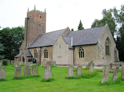
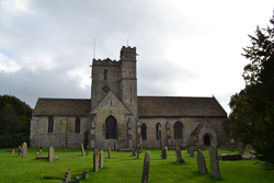
Parish church, formerly Augustinian house
Leonard Stanley is located 4 miles south-west of Stroud and around 10 miles north-east of Berkeley. Positioned south of the small triangular village green, the former priory church of St Swithun is an aisleless cruciform building with a crossing tower and north nave porch, constructed of coursed rubble limestone. The chancel, nave and transepts all date from the C12th, as does the lower stage of the crossing tower. When first constructed, the chancel appears to have possessed a vaulted ceiling as evidenced by the six remaining stone responds. The upper levels of the tower appear to date from the late C13th while the porch is a C14th addition. Most of the C12th windows were replaced in the 13th and 14th centuries with larger Decorated and Perpendicular windows. C12th round-arched windows are visible on the north side of the nave immediately west of the porch, the south side of the nave and the south transept.
The church once had a cloister projecting from the south side of the nave. All that remains are two blocked doorways on the south side of the nave and a doorway in the west wall of the south transept. There are two blocked doorways, one on the east side of the north transept and the other on the east side of the south transept, that were once the entrances to two chapels that projected from either transept.

