The Corpus of ROMANESQUE SCULPTURE in Britain & Ireland

North Somerset (now)
Parish church
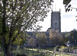
The small town of Portishead occupies a strategic position on the S side of the mouth of the river Avon, and once enjoyed a trading importance subsidiary to Bristol, 8 mi away to the East. Now in North Somerset, Portishead was part of the County of Avon between 1974 and 1996. The town church of St Peter is in a surprisingly quiet area, surrounded by an airy rural atmosphere: no wonder local people refer to it as the ‘village’. The church has Romanesque origins but was rebuilt in the 14thc and 15thc in Perpendicular style. It was altered and extended to the east in 1878-9 using old materials and features. The font is Romanesque; there is also a possible early altar slab.
Parish church
The small village of Blagdon is in the Mendip Hills, 11 miles SW of Bristol. It lies on Dolomitic conglomerate bedrock at an altitude of about 100m above OD on the fairly steep south side of the upper Yeo valley. The Black Down after which the settlement is named is an expanse of upland heath on Portishead Beds of Old Red Sandstone 2.5km to the SW; its summit, Beacon Batch, is the highest point of the Mendips at 325m above OD. Above the village towards Black Down the underlying rock is composed of bands of limestone of varied width (specifically: Hotwells Limestone-Harptree Beds-Clifton Down Limestone-Burrington Oolite-Black Rock Limestone-Lower Limestone Shale); below, down to the reservoir NE of the village (Blagdon Lake - opened in 1901), is the inevitable Mercia Mudstone (Keuper Marl). The village looks across its lake to gentle Lias hills on the other side of the valley — hills which hide from view the conurbation of nearby Bristol.
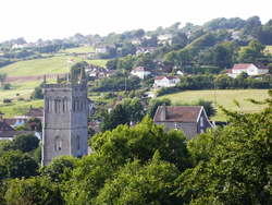
Blagdon village lies along the main A368 Weston-Bath road and adjoining lanes. The church part of the village is kept discrete from the commercial part by a deep combe which even today preserves a totally rural landscape; the two parts are connected by a footpath which gives fine views from the west of the church on its eminence (at an altitude of about 100m above OD) commanding the lake.
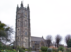
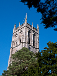
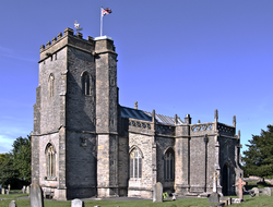
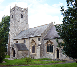
St Andrew’s is a very grand large church which has been obviously refurbished by Bristol mercantile money, probably more than strictly necessary for fabric-survival: a building proclaiming proud patronage. This healthy situation (for the fabric) is possibly now ended since the last substantial contributions came from Wills tobacco money and the present congregation is unable to match those. It has an aisled nave with a south porch, a short chancel and an impressive 4-storey W tower. The tower is 15thc but the rest of the church is by Sir Frank Wills of 1907-09. Construction is of closely jointed squared and coursed dressed stone to the tower and rock-faced rubble squared and coursed with ashlar dressings to remainder. The only Romanesque feature is a piscina with figural carving.
Parish church
Bleadon Hill is the most westerly remnant of the Mendip Hills, except for coastal Brean Down and the island of Steepholm in the Bristol Channel: an attenuated fragment, at that. A moment’s thought about the place-name brings the realisation that it is tautological, the ‘don’ element meaning ‘hill’; the first element tells us that the hill was thus named for its varied colour, perhaps the effect of Black Rock Limestone protruding above the grass, according to Ekwall. The settlement, sheltered under the S slope of the hill after which it is named, probably owes its existence and importance to being at the point where the W-E route under the S scarp of the Mendips from Wells through Cheddar and Axbridge meets a major coastal S-N route (the former still a narrow twisting lane; the latter represented today by the main A370 connecting the vast conurbation of Weston-super-Mare 2 miles to the NNW with the main trunk A38 road, precursor to the M5, between the Midlands and the South-West, 2 miles to the SSE). Bleadon is also on the major river Axe, navigable at least up to this point. Bleadon just escapes that more tangible disturbance of the Somerset landscape, the M5, which runs 2 miles away to the west. Geologically, most of the village around the church (which is only 15 m above sea-level) lies on Keuper Marl above the alluvium of the Somerset Levels and below the Black Rock Limestone of Bleadon Hill; there are also outcrops nearby of dolomite and a little oolitic Limestone. The village is an extensive one, running a mile from E to W and a similar distance from N to S along the roads of a staggered crossroads, with the church standing in the centre.
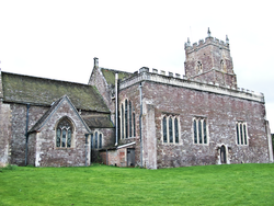
The present building dates from the 14thc (dedicated in 1317), but is mainly 15thc. It was restored and its chancel shortened in the mid 19thc. It consists of a chancel with a N organ chamber, a nave with S porch and a W tower. Construction is of coursed rubble with freestone dressings. The font is 12thc as is one reused carved head, set in the exterior S chancel wall. An angel, now set on the internal nave wall, may be pre-Conquest in date.
Parish church
Burrington is a village in the Mendip Hills, 10 Miles SW of Bristol. The village lies just north of the N scarp of a limestone ridge of the Mendip Hills on the south side of the Yeo valley. Much of the settlement lies on Dolomitic Conglomerate but the church itself, on the north-west side of the village facing open country, lies on Head at an altitude above OD of about 70m. Below the village to the north there is Head and then Mercia Mudstone (Keuper Marl) before the Alluvium of the valley of the river Yeo (1.5km to the NE). Above the village, rising to the highest point on the Mendips, Black Down at 325m above OD, the geological sequence is Hotwells Limestone-Harptree Beds-Clifton Down Limestone-Burrington Oolite-Black Rock Limestone-Lower Limestone Shale-Portishead Beds (Old Red Sandstone). The nearest main road, 200m N of the church, is the A368 connecting Weston-super-Mare with Bath via Banwell. The A368 crosses the trunk A38 at Churchill 3km to the west. Thus Burrington is within close reach of good roads.
The church consists of an aisled nave with a S porch, chancel and W tower, and is constructed of coursed rubble, freestone and ashlar dressings. The W tower is 14thc and the remainder is substantially 15thc, restored in 1884, but a carved head above the tower W window and a relief panel within the sanctuary might be from an earlier church. They are described here since they have been described as possibly of Romanesque origin.
Parish church
The large village of Banwell lies at c.8m above sea-level at the foot of the N slope of the W end of the Mendip Hills, adjacent to a gap utilised by a road undoubtedly ancient and now represented by the A371 connecting Weston withWells and Shepton Mallet via the towns strung along the S scar of the Mendips (the nearest and most important being Axbridge). Banwell Hill to the SW rises to a height of 118m; Banwell Plain to the SE to 96m: each hill being only 1km away from the village, it is somewhat starved of the sun. Its altitude is not high enough for it to enjoy a commanding prospect over the alluvium towards the North Moors and the limestone ridge of Milton Hill and Worlebury Hill. Nevertheless, it seems to have been the administrative centre of the area in the Middle Ages, bothecclesiastical and secular (v. Aston & Costen). These days, its business for the cursory visitor appears dominated by the constant main road traffic following the official route between the M5 and Bristol Airport; new building seems to be spreading the village westwards towards Weston-super-Mare, using the land of the now decommissioned airfield.
As suggested in the general comments on the county of North Somerset, communications are easy here. Banwell is only 8.5-9.0 kms from Weston via the A371, 2kms from the A38 and less than 20kms from Bristol via that trunk road. The M5 runs a mere 2kms W of the village and is accessible at the junction with the A370 5kms N. When railways were more important for local journeys, Banwell had a station (2kms E) on the branch coming off the main line at Yatton to the N and running through the gap in the hills S of Winscombe round S of the Mendips to Wells and beyond.
Geologically, Banwell village lies mostly above the nearby alluvium on Mercia Mudstone and below limestone rock.
The church is at the old village centre (although the village itself has expanded largely westwards). It is largely of the 15thc and consists of a W tower, nave with N and S aisles and S porch, and chancel. The church was restored twice in the 19thc. The only Romanesque feature is the font.
Parish church
Badgworth is in the centre of the county, 9 km inland from Burnham-on-Sea and 10 km S of Weston-super-Mare. The village consists of scattered houses on a loop of roads to the S of the A38, at the foot of Brinscombe Hill, a W extension of the Mendip Hills and the church also stands on this loop. To the SE of the village stands Badgworth Court. Badgworth looks across the valley of the river Axe to Crook Peak, about 3.5 km NNW. There is also a good view WSW to Brent Knoll. Agriculture has always been rich hereabouts, especially livestock-farming.
The rare dedication to St Congar (proudly claimed in the church guide as unique) is to be linked with the principal Somerset site associated with the saint at Congresbury, about 7 miles NNE. The squared rubble church consists of a 14thc chancel and N chapel, nave with a S porch and a 16thc W tower. The only feature described here is the font
Parish church
Now known as Churchtown, the tiny original village of Backwell (‘stream coming from the ridge’) nestles in a shallow combe in the northern scarp of the limestone ridge which defines the southern side of the Yeo valley. It lies, at an altitude of about 60m above OD, on the very upper part of the Dolomitic Conglomerate bedrock, just below the Clifton Down Limestone of the ridge. This ridge rises above Backwell to a height of about 170m above OD. Naturally, Backwell is close to several limestone quarries: there are at least three within a kilometre of the church, the nearest a mere 200m from the church, in Cheston Combe. Below the original village centre, the geological sequence down to the river valley Alluvium is the expected Mercia Mudstone (Keuper Marl), then Head.
Running along the bottom of the NW-facing slope is the extremely busy A370 linking Bristol with Weston-super-Mare and the M5 just short of Weston. Predictably, Backwell has expanded in a ribbon along this road (and also along the three lanes which run downhill to the north, north-west and west from Churchtown to meet the main road). Continuing expansion is filling gaps. Contemporary Backwell is a very large dormitory settlement indeed. The middle of the three lanes mentioned continues across the A370 towards the even larger dormitory of Nailsea, past the railway station; there is a small stretch of road within the parish N of the station not bordered by houses; otherwise, Backwell and Nailsea would be connected. The railway is the main Bristol-Exeter line of the former GWR. It is very busy, mostly with long-distance trains, but some such stop at Nailsea and Backwell station because of strong commuter demand.
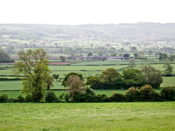
Despite all the recent development, there is a fine view from Backwell church across the mostly pastoral landscape of the Yeo valley, skirting the eastern edge of Nailsea, to the original local mother church of Wraxall (3.5km to the N). Taking a view which skirts the western edge of Nailsea, one may also see Chelvey church (2.7km to the W), nowadays closely connected with the Backwell ministry.
The church consists of W tower, nave with N and S aisles and S porch, and a chancel with N and S chapels. Construction is of coursed, squared rubble with freestone dressings except for the tower, which is of ashlar. It dates from the 12thc and was altered and enlarged in the 13thc and in the 15thc, when the 100ft tower was added. Further alterations were made in the 16thc, and it was restored in the 17thc. A new building attached to the N side of the church and containing social and office space was added in 1984. Romanesque features described here are the font, a reset chip-carved stone in the S (Rodney) chapel and a head serving as a label stop, possibly re-used, on the S chancel doorway.
Parish church
Portbury lies at the northern tip of Somerset by the river Avon and was a Roman port for exporting silver and lead from the Mendips. In early medieval times, it was a large estate dominating the land immediately S of the mouth of the Avon comprising the six manors of Portbury, Portishead, Clapton-in-Gordano, Easton-in-Gordano, Walton-in-Gordano and Walton-in-Gordano. It may have been even larger; its influence seems to have been very considerable, according to recent research by Stephen Rippon. Portbury village lies mostly on Mercia Mudstone (formerly Keuper Marl) cuddled up to Black Nore Sandstone (Lower Old Red Sandstone) separated by Portishead Beds of Upper Old Red Sandstone from the Carboniferous Limestone ridge which extends from Clevedon to the south-west to Pill immediately north-east, where the rock is cut by the Avon, which river is 2.5kms from the village at its nearest. Now in North Somerset, Portbury was from 1974 to 1996 in the county of Avon.
The church of St Mary rests at an altitude of just over 10m OD on Mercia Mudstone above Head and Alluvium. The church is Grade 1 listed and comprises work from the 12th, 13th and 15thc with a restoration c.1870. It comprises a W tower, nave, north and south aisles, south porch, chancel and chantry chapels. There is a Romanesque S doorway, font and chancel arch amongst other features.
Parish church
At an altitude of 40-45m OD on the SE slope of a modest hill (up to 113m OD) in the western Mendips, the small settlement of Christon occupies quite a dramatic situation on the W side of the gap formed in the Mendip Hills by the Lox Yeo, 1.8km N of that river’s confluence with the major Axe: to the N lie the forbidding hills; to the S lie the Somerset Levels, no doubt equally if not more forbidding in medieval times. Possibly the principal thoroughfare then was the narrow and winding lane still running along the bottom of the southern scarp of the Mendips between Bleadon and the coast to the W and Axbridge and Cheddar to the E. Even today, roads to the S of that lane are few and little used until the main A38 is reached; to the N, communications are a little better because they can use higher ground: the road from Loxton 1.5kms to the S winds along the valley side and there is a comparable lane on the eastern side. Except for the large village of Winscombe 4kms to the E, Christon shares this remote area only with the slightly larger hamlet of Loxton to the S. This isolation is rudely underlined rather than attenuated by the jarring, jeering, M5 which roars up and down the valley. About 700m NW of the Lox Yeo river (and an ear-splitting 400m from the motorway), the church lies on the lane reasonably centrally, next to the Court, the modern successor to the manor house. Geologically, most of the hamlet lies on Dolomitic Conglomerate above the valley slope’s Mercia Mudstone and the valley bottom’s Alluvium; above the Conglomerate is the hill’s Black Rock Limestone. The place-name was originally just ‘Cyrc’ or ‘Cryc’ (= creech = hill), the Saxon ‘tun’ being a later addition. Prehistoric exploitation of the immediate area is evident from the remains of agriculture; Roman remains were also discovered when the M5 was built, where that road scrapes the NE edge of the hill behind Christon.)
The church comprises a nave with a S porch, a central tower and a chancel. Work is found from the 11-12thc, 14thc, 16thc and 1875. The earliest masonry is in the chancel, which has long-and-short work in the E quoins and herringbone masonry in the lateral walls. From the later 12thc are the S nave doorway, the restored arches, vault rib supports and corbels of the tower and the font. Construction is of rubble with squared quoins. The author is indebted for some information to Elaine Jamieson of English Heritage, who led a party from the Bridgwater Archaeological Society around part of the hamlet, focusing particularly on field-systems ― prehistoric and medieval ― on the hill to the N.
Parish church
The parish of Churchill (‘church hill’, of course) covers quite a large area and has no obvious sense of focus unless that is the cross-roads of the A38 Bristol―Bridgwater trunk road and the A368 Bath―Weston-super-Mare: an extremely busy junction with traffic lights 1km ESE of the church. To the south the parish is bounded by the northern limestone ridge of the Mendip Hills (with its quarries); to the west, along the A368, there is some ribbon development towards the next villlage of Sandford; to the north-east, mostly developed along past and present alignments of the A38, the parish incorporates the large village of Langford. The older houses of Churchill seem to be along the lane which leaves the A368 500m west of the A38 to proceed WNW towards Churchill Green. A turning N off this lane takes one along a lane towards Congresbury (3.5km distant). 500m along this lane one will find the church, totally alone except for the adjacent manor house. There is virtually open pastoral countryside to the N; to the NW lie the Yeo valley and the North Somerset Levels (the Yeo running through Congresbury). Thus, the church is just about at the north-west extremity of the settled part of the parish. (A narrow and sharp salient of the parish extends NW from the church across the moors towards Puxton.) Its situation gives a sense of peace which is a treasure in this part of Somerset hectic with dense, noisy and fast-moving road traffic.
Its altitude of about 30m above OD gives the church some eminence over the land to the north. This is because it was built on the expanse of Mercia Mudstone (Keuper Marl) which rises above the Alluvium of the Levels.
The church consists of an aisled nave with a S porch, chancel and W tower. It is 12thc origin, with 14thc and 15thc rebuilding and a 1879 restoration. Construction is of coursed rubble throughout except the W façade of the tower, which is of squared and coursed dressed stone. Approximately two courses above the water-table on the west face of the turret at the SE corner of the tower, there is an inverted block with an incised scratch-dial, not recorded in detail but photographed. The only Romanesque sculpture is the font.
