The Corpus of ROMANESQUE SCULPTURE in Britain & Ireland

Somerset (now)
Parish church
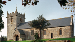
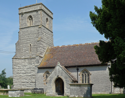
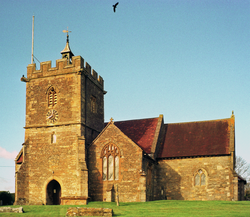
The parish of Moorlinch, which is on the southern slopes of the Polden ridge, lies 6 miles E of Bridgwater. Most of the land lies on Keuper marl, with irregular areas of clay and limestone on the higher slopes, and alluvium between the marl and the peat of Sedgemoor. The church of St Mary, which is in a prominent position and dates from the 13thc., consists of a nave with S porch, chancel and W tower. The outer doorway contains restored Romanesque work. The tub font is also perhaps Romanesque work.
Parish church
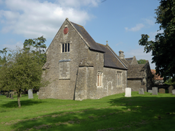
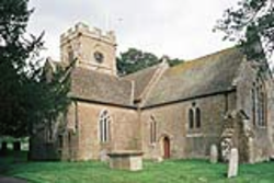
The manorial hamlet of Laverton lies in rich farmland 8.5 miles S of Bath, about halfway between Frome and Norton St Philip. It is in a dip: the N-facing side is a valley of the Hennambridge Brook, a tributary of the river Frome. The manor house (now belonging to the Duchy of Cornwall) and church of St Mary are adjacent. The church, which is built of rubble, consists of an unusual W end, which Pevsner finds to be reminiscent of a westwerk (described as a tower in the HE listing), nave, N porch, chancel and vestry. It is mostly of the 11thc, with 15thc alterations. There was a restoration in 1859. The Romanesque elements consist of N (and possibly S) nave doorways and two windows in the western section.
Parish church
The small settlement of Staple Fitzpaine is sited near where a road (unclassified but well-used) running roughly NNW/SSE between Taunton to Chard crosses a stream running WSW/ENE down from the Blackdown Hills. The former mill using that watercourse is sited a very short distance NW of the crossroads at the village centre. Crossing the Taunton-Chard road at that crossroads, a lane runs roughly SW-NE, parallel to the stream, along the S side of the shallow valley from Staple Hill towards lower ground to the NE and major communication lines of road and rail.
Emphasising the political standing of the Count of Mortain, the parish still includes (at its SE corner) his castle, Castle Neroche. By area, the parish is the second largest in the county, but by demography it is diminutive, probably having changed very little over time. Staple Fitzpaine has its own manor-house, adjacent on the N side of St Peter’s church. Resting on the large block of Blue Lias which stretches from here NE far into the central area of the county, the village has a good source of favoured building-stone. Inevitably, the area is almost entirely agricultural in character.
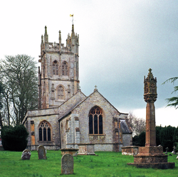
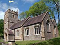
The church, which consists of a W tower, a nave with N and S aisles, a S porch, avestry and a chancel is Norman in origin but has been largely rebuilt. The Romanesque S doorway has been reset in the S aisle.
Parish church
The compact village of Edington lies on the N side of the Polden Hills on a lower slope in the Sedgemoor district of Somerset, about 8 miles W of Glastonbury. Edington was a chapelry of Moorlinch until it became a separate parish in 1863. The church was completely rebuilt in 1878-79 by Edwin Down in a fabric of coursed and squared rubble with freestone dressings. The present building consists of a nave with a small N transept, chancel with N vestry, a S porch, and a W bellcote. The only Romanesque feature is a font.
Parish church
Lcoking is 3.5 mi SE of Weston-super-Mare. The original settlement lies on the W tip of a small outlier of Blue Lias (stretching 2.5 mi E to Banwell village) between the limestone of Bleadon Hill 2 mi to the S and Milton Hill 2.5 mi to the N (both forming parts of the extreme westerly reach of the Mendip Hills). The S side of the village ends abruptly at a scarp above Locking Rhyne; the church, at about 18m above sea-level, is near the edge of that scarp and enjoys a relatively rural aspect to the S. Locking is named after its original inhabitants ‘Loccingas’ (i.e., ‘Locc’s People’). From 1974 to 1996 Locking was in the County of Avon. The church dates from late 14thc/early 15thc, and was restored in 1814/16 and in 1833. It has a noteworthy Romanesque font.
Parish church
The tiny hamlet of Lovington (Lufa’s tun) lies 1km S of the Somerset river Brue and only about 500m N of the Cary, on the SW edge of a terrace deposit of gravel on top of the locally predominant Lower Lias rock, with extensive tracts of such terrace deposit to the NE. The church is about 0.5 mi S of the secondary B3153 road linking Castle Cary to Somerton. The church has 13thc origins. The tower, nave and porch were all rebuilt from 1861-3. There is a font of unknown date, most probably post-c.1200, but which is included here for reference.
Parish church
North Cheriton lies about 3 miles WSW of Wincanton on the modern-day A357. The church of St John the Baptist (at c.120m altitude) makes a group with its attendant manor house and farm. The present church has 14thc origins but was largely rebuilt in 1878. It is built of local stone quarried from Cheriton Hill, some 150m from the church, and Hamstone. The Romanesque elements comprise the font and a corbel sculpture.
Parish church
The village of Puckington, Somerset is situated 10 miles SE of Taunton and 10 miles W of Yeovil. The church, which is built of rubble, is mostly of the 13thc and 15th with later work. It consists of a W tower, nave, large mid-19thc transept, chancel, S porch and vestry. The font is Romanesque.
Parish church
The village of Kilmersdon lies at the head of a valley leading N through the Mendip Hills to Radstock. It straddles the secondary road between Norton St Philip and Chilcompton, which road climbs to the W of the village up to the ridge along which runs N-S the Fosse Way and, to the NE, around Ammerdown Park up to the ridge along which runs the Frome-Radstock main A362 road.
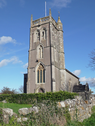
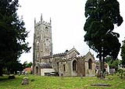
The church is of Norman origin, although much of the existing fabric dates between the 15th and the 16thc; the church was restored in the 19thc. It consists of a W tower, a nave, a chancel, a N aisle with a chapel, a S organ loft and a vestry. The Romanesque elements comprise the window in the nave S wall (reopened in 1898), the plain narrow S doorway (now into the vestry) visible from the nave, remains of a chancel N window (again visible only from inside), many stretches of a fish-scale frieze outside, part of a corbel table on the nave walls and built-in fragments of carving inside (chancel N wall) as well as outside.
Parish church
Templecombe is situated on the A357 5m S of Wincanton and 12m E of Yeovil. The church, which is located in the centre of the village, has Norman origins, but was rebuilt in the 19thc. It consists of a S tower incorporating a porch, nave with N aisle and NE corner vestry and chancel. The font is Romanesque.
