The Corpus of ROMANESQUE SCULPTURE in Britain & Ireland

Buckinghamshire (pre-1974 traditional (England and Wales))
Ruined parish church
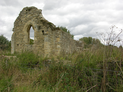
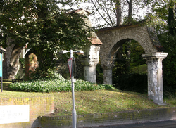
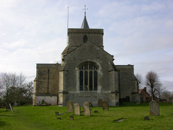
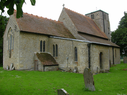
Stantonbury is on the N side of Milton Keynes and is one of the former villages of Buckinghamshire that were absorbed into the new town after its boundaries were designated in 1967. In 1913 RCHME noted that the church was in good condition and had been recently restored. The church was still in use in 1927, when the VCH described it as a small, rubble building consisting of a nave, chancel and N porch. The chancel contained the oldest fabric, seen on the S wall, and a new nave was added in the 1st half of the 12thc. An aisle or chapel was built on the S side of the chancel but later removed and in the 13thc a N aisle was added to the nave and the N chancel wall was rebuilt. The nave was shortened by 10 feet at the W end in the 15thc. The N aisle was removed, perhaps in the 16thc when the arcade was blocked and the N porch added. According to Pevsner and Williamson (1994), excavations have shown that there was a W tower. The most interesting feature was the small chancel arch, which survives but was removed when the roof collapsed in 1956 and has since been installed in St James’s church, New Bradwell (qv). No Romanesque sculpture remains on site.
Hospital, former
High Wycombe is the second largest town in the traditional county (after Milton Keynes) with a population of 92,300 in 2001. It is a market town in the south of the county, 29 miles WNW of Charing Cross. The hospital stands on the old London road (A40), and comprises the ruins of the Infirmary Hall; an aisled hall originally of four bays running N-S. In 1767 it was reduced in length at the S end for the widening of the London road, and most of the other standing buildings were demolished. What remains is a roofless structure with the lower part of the outer N wall standing, and two bays of each arcade along with the third pier of the W arcade without its arches. The ruins were consolidated with brick supports in the late 19thc, and mortar repairs were made to the foundations in the 20thc.
Parish church
Ludgershall is a village in the Aylesbury Vale district of the county, 12 miles W of Aylesbury and close to the Oxfordshire border. The church is on the S side of the village, on the Brill road, and consists of a chancel, rebuilt in the 14thc, a nave with 4-bay N and S aisles whose arcades are 14thc with some striking capitals carved with large figures with linked arms. The W bays ofthe nave flank the 15thc W tower, and there is a 13-14thc S doorway under a 15thc porch. Construction is of limestone rubble. According to RCHME (1912) the entire church apart from the porch and the chancel were then covered with rough-cast. The only 12thc feature is the font.
Parish church
Waddesdon is a good-sized village 5 miles NW of Aylesbury on the Roman road ofAkeman Street. The village is dominated by Waddesdon Manor, on a Lodge Hill to the W, but there was no medieval manor house here; the present house, built for Baron Ferdinand de Rothschild from 1874-80, was the first on the site, and Rothschild built the present village to the E of the old village centre at the same time. Nevertheless evidence of continuous settlement here goes back to the bronze age. The church stands in the centre of the old village, opposite the gates to the manor, on the N side of the A41 which approximately follows the line ofAkeman Streetthrough the village. St Michael’s is a large church with an aisled nave with S porch, chancel and W tower. The nave is late-12thc, with an elaborate S doorway under a 14thc porch, rebuilt in 1902. The nave aisles are of six bays with clerestory windows above the piers. The N arcade is uniform, with the octagonal piers, finely moulded capitals and convex chamfered arch orders typical of the first years of the 14thc, and the use of forms of Y-tracery in most of the aisle windows confirms this dating. The S arcade, however, reveals a more complex history. The two E bays, including pier 1 but not pier 2, have the same design as the N arcade. The next three bays also have pointed arches, but with late-12thc details, the piers are cylindrical and the capitals are scalloped. Then pier 5 has a roughly moulded capital of a mid-13thc type, and the arch of bay 6 has deep double chamfers, also diagnostically mid-13thc. Finally the W respond returns to the scalloped design of piers 2-4. What this suggests is that a 12thc arcade of four bays (the present bays 2-5) was extended westwards by a bay in the 13thc; the W respond being reused n the new W wall, a new being pier inserted (pier 5) on the line of the old E wall and a new arch built (bay 6). Then in the early 14thc the aisle was extended by a bay to the E, the original pier 1 being retained as the new pier 2, and the arch of the old bay 1 being rebuilt in the new style. Piers 2, 3 and 4 have (or had) slim shafts rising from the impost blocks on the nave face, terminating in small scallop capitals, but carrying nothing. Small statues are a possibility, or transverse arches or, perhaps likeliest, roof trusses. The clerestory is 15thc, and its insertion, together with the raising of the nave walls and flattening of the roofline, was presumably responsible for the loss of the original trusses, supported by the shafts above the pier capitals.
The chancel dates from the early 14thc campaign, being rebuilt a bay further east than the 12thc chancel. The tower is of the late 14thc, with Perpendicular bell-openings, a polygonal SE stair with a battlemented turret rising higher than the main parapet, and angle buttresses at the W. It was taken down and rebuilt in 1891-92. A sign of an early restoration is given by the rainwater heads, dated 1736, and the church was completely restored during the incumbency of Richard Burges (1859-67). The nave and chancel are mortar rendered, and the tower is of irregular ashlar blocks. Romanesque sculpture is found on the S doorway and S nave arcade.
Parish church
Old Bradwell was described in 1927 as a scattered village with the church at its southern end and the Manor Farm a little to the north (VCH). Nowadays most of the village has been absorbed by the building of Milton Keynes, but the church stands on the edge of the residential area in North Loughton Valley Park, a long green area following the line of the Loughton Brook. The church consists of a nave with a S aisle and N porch, a chancel and a saddleback W tower with a modern annexe on the N side of it. The oldest parts are late -12thc or early-13thc, and the church was heavily restored in 1868 and by E.Swinfen Harris in 1903. Construction is of limestone rubble with ashlar facings. The only Romanesque sculpture is in the S arcade.
Parish church
Bradenham is a small village in the Chilterns, consisting of a few houses, a pub, the church and a manor house all on a minor road off the A4010, some 3 miles NW of High Wycombe. Church and manor stand side by side facing an enormous green in the hilly, wooded landscape. The church consists of a chancel (rebuilt 1863-65) with a 2-bay N chapel added in 1542, an aisleless 12thc nave with a 19thc S porch and a short 15thc W tower with a pyramid roof behind a plain parapet. The church was restored by G. E. Street in 1863 and 1865. Construction is of flint and the chapel is rendered. Romanesque sculpture is found on the S doorway.
Parish church
Cheddington is a village in the east of the county, towards the Bedfordshire border, 6½ miles east of Aylesbury. It is built on the northern slopes of the twin hills of Westend and Southend, both of which were anciently terraced for cultivation. There was an Iron Age hillfort on Southend Hill, one of a string along the Chilterns, and discoveries of pottery attest to Roman occupation in the area. Traces of a Roman road have been discovered running through Pitstone and along Cheddington High Street. The church stands outside the village towards the north. It consists of a nave with a N aisle and S porch, a chancel with a 19thc N vestry, and a W tower with a polygonal S stair. In 1993 a kitchen and lavatory block was built on the N side of the tower, entered from the nave aisle. Inside the nave, a row of three carved corbels along at the S wall, with the remains of two more at the NW and SW angles, all at a height of 3m, suggest that this is 12thc fabric. On the exterior of the S nave wall a break in the coursed ashlar masonry to the E of the easternmost corbel suggests that the nave was later extended eastwards. The 12thc corbels supported a roof that was heightened in the 15thc, when tall, two-light, square framed windows were installed. The N aisle with its 3-bay arcade was added at the same time. There is no clerestorey. The aisle windows are of the same design as those in the nave wall, and the blocked N doorway is 4-centred. The chancel arch is 14thc, and the chancel itself must date from the same period, but new windows like those in the nave and aisle were added in the 15thc. The E window is a 3-light geometrical design added in 1854-62. The N vestry was added in 1858. The tower and its arch are 15thc work, except for the plain parapet which is modern. There was a general restoration in 1858, when the S porch was rebuilt. A large number of Romanesque carved stones were built into the fabric at the time of this restoration, including a volute capital in the E wall of the vestry, the remains of a doorway and a section of stringcourse inside the S porch, and relief panels inside and outside the porch that came from the same doorway. The interior corbels and the reset stone are described below.
Parish church
Chenies is a village in E Buckinghamshire, within half a mile of the Hertfordshire border and under three miles E of Amersham. The village stands on rising ground on the S bank of the river Chess with the church at its heart and Chenies manor, an attractive brick manor whose oldest parts date from the 1460s, immediately to the W. Despite the proximity of such commuter towns as Amersham and Chalfont, and the main rail link to London running nearby, Chenies has sustained an attractive village character. The Chess valley here is heavily wooded and largely given to pasture.
St Michael’s consists of a nave with no clerestory but a S aisle, extended alongside the chancel by A. J. Pilkington in 1896-97 to form a S organ chamber, a W tower and, running the entire length of the N side of the church, the Bedford Chapel begun in 1556. The church dates largely from a reconstruction begun in 1479 that continued for 30 years; Sir David Philip, then resident in the manor at his death in 1506, left £4 in his will to “fynyshe my building of the parish church of Chenies”. The 4-bay S arcade is of this date. The Bedford chapel was built in 1556 by Anne, Countess of Bedford according to the will of her husband, Sir John Russell, the first earl. It communicates with the church via three glazed arches, one in the chancel and two in the nave, and is, according to Pevsner, “the richest storehouse of funeral monuments in any parish church of England.” Unfortunately this treasure-chest is not accessible to the casual visitor, nor are the monuments easily visible from the nave, since the chapel lights can only be turned on from inside it. The chapel has been enlarged several times since the 16thc. In 1861-62 Henry Clutton extended the vault northwards under the churchyard; in 1886-87 the chapel itself was extended westwards with a vault below by A. Macpherson of Derby, and a N aisle was added and the chapel extended to the E by Bodley in 1906-07. The west tower has diagonal west buttresses and a polygonal turret taller than the tower at the SE angle, a common Buckinghamshire feature. It is fitted with large Perpendicular bell-openings and has a battlemented parapet with gargoyles at the angles. The church is constructed of flint rubble, and the 19thc churchyard wall is of knapped flint and ashlar chequerwork. The church itself was restored twice in the 19thc; by Clutton (1861-62) and Macpherson (1886-87). Vestiges of the pre-15thc church survive in the 12thc font, one of the Aylesbury group, and a loose 12thc volute capital.
Parish church
Bierton is a village on the NE outskirts of Aylesbury, extending for a mile along the
A418 to Leighton Buzzard; a busy road that robs the village of much of its character.
The surrounding landscape is largely pasture. The church is alongside the A418 on its
S side, so that the main entrance is the N doorway, under a timber-framed and
mortar-rendered porch. To the SW of the church is St Osyth's
Well. St James's is a long, broad cruciform church with a low crossing tower. It is of coursed rubble construction and dates from the
early 14thc. The nave is aisled, with 4-bay
arcades. There is no clerestory in the central vessel but
high-level windows were added to the aisles when their roofs were raised and the
pitch flattened, perhaps in the 15thc. The arcades have quatrefoil
piers and finely moulded capitals, and the crossing
piers belong to the same campaign. The aisleless chancel has Y-tracery lateral windows with extra bar-tracery
cusping, and a 4-light east Perpendicular window, probably
c.1500. The N transept is now a chapel; the S has been converted for use as a vestry. The only Romanesque feature is the font.
Parish church
Lillingstone Dayrell is in NE Buckinghamshire, 3½ miles N of Buckingham and just 1½ miles S of the Northamptonshire border. The present village consists of a few houses on a lane off the A413 Buckingham to Towcester road, but the church stands outside the modern village to the N, accompanied only by the buildings of Manor Farm and otherwise surrounded by fields. It is approached by a track from the W. The landscape is generally hilly and wooded; much given over to rough pasture now but originally forming the extensive woodland described in the Domesday entry (see VII). To the S and W of the church is a large wheatfield. The area was systematically walked by the Whittlewood Project in Autumn 2000, and their pottery finds revealed a great deal about the history of the village. It was occupied by the Romans, but the distribution of Romano-British pottery was too random to provide useful evidence of the settlement pattern. Later, but before the Conquest, pottery finds indicated that the village street followed the line of the present track to the W of the church. Shortly after the Conquest the village expanded with a second concentration indicating another street parallel to the first but further S. After 1450 it contracted again, back to its original focus along the track. To the SW of the church was the Manor House, but remains of this were lost when the ground was ploughed up in 2000 to form the large wheatfield described above.
The church is of limestone rubble and consists of an aisled nave with no clerestory and a S porch, a chancel with a 19thc N vestry and organ chamber and a W tower. The nave is tall with very simple and small tower and chancel arches of around 1100. The 3 bay aisles were added in the 13thc, and the S porch in the 15thc in a rich reddish brown stone that was also used for the 15thc S aisle window. The N aisle windows are 19thc in a simple 13thc style that was also used for the vestry. The chancel was also heavily restored in the 19thc, but retains one original 13thc window decorated with dogtooth, and a 13thc low-side window, both in the S wall, as well as 13thc wall arcades and tomb recess inside. The interior of the chancel is dominated by the large, centrally placed tomb of Paul Dayrell (d.1571) and his wife, and on the S side is another tomb chest with brasses commemorating an earlier Paul Dayrell (d.1491) and his wife. The tower must be 12thc in its lower parts, but its bell-openings are early 13thc. It is unbuttressed and has a flat top.
In the 17thc the church was in a poor state of repair, so that the N aisle was demolished, its arcade blocked off, and its stone used to repair the rest of the building. In 1868 a restoration was carried out byG. E. Streetin 1868, and he was responsible for the rebuilding of the N aisle and the vestry and organ chamber. In 1952 this vestry was converted into the Chapel of Our Lady. Features recorded here are the tower and chancel arches.
