The Corpus of ROMANESQUE SCULPTURE in Britain & Ireland

Roxburghshire (pre-1975 traditional (Scotland))
Ruined parish church
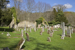
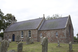
The ruined church is composed of two compartments, the eastern one used as a burial enclosure. Built into one of the S nave windows is a reused decorated stone fragment, and in the adjoining churchyard there is a coped, tegulated grave cover. After the Reformation, the barony of Ancrum passed first to the Duke of Richmond and Lennox, and later to the Earl of Roxburgh. Towards the end of the 17thc, the parishes of Longnewton and Ancrum were annexed. At one time there were two villages, Over and Nether Ancrum. Both were burned during the English attacks of 1544-5. The church was rebuilt in 1761-1762 and further work undertaken in 1831-1832. It was finally replaced with a church newly built near the village green in the late 19thc. After this the old church was reduced to form a romantic ruin for William Scott of Ancrum. After the Reformation, the barony of Ancrum passed first to the Duke of Richmond and Lennox, and later to the Earl of Roxburgh.
Ruined parish church
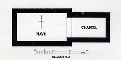
The Wheel Kirk was sited beside the Wheel Causeway in Liddesdale. Although the church and village have long disappeared, in 1914 excavations were carried out on the site of the church, when various carved stones and the foundations of the church were unearthed. The excavations showed a two-celled church with a rectangular nave and narrower, rectangular chancel. It is uncertain when the church was abandoned, but it appears to have occurred after the Reformation. In 1600 the 'Quheill' Church in Liddesdale is mentioned as 'waist' and valued at £10. On 9 December 1604, the Wheel Kirk was united to Castleton. The church was still marked on Blaue's map in 1648, but by the mid-19thc nothing survived above ground.
Parish church
There have been numerous changes to the church. Repairs were undertaken in 1616, but in 1754 the chancel was shortened. Then, in 1774, after the collapse of the W gable, the nave was shortened. In 1784 further work on the church was carried out and still more in 1813. New windows and a new porch were constructed in 1857-8, at which time, the medieval tympanum was moved from its position over the S nave doorway to the outer arch of the new porch. Finally, in 1910-12 the chancel was rebuilt and other work carried out.
Parish church
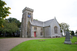
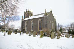
The parish church of Minto was moved to its present site in 1830-31, when the design was carried out by William Playfair. A number of carved stones from the old church site are deposited inside the tower.
Parish church
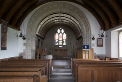
The church was to a large extent rebuilt in the 17th and 18th centuries, but some of the 12th-c wall still survives, including 2 blocked windows in the E wall and a blocked window in the N wall of the chancel. There is also a later blocked doorway in the S wall of the chancel. This appears to have replaced another doorway (now a window) west of it. The original plan of the church consisted of a rectangular nave and smaller rectangular chancel at the east end. A loose stone with carving on one side is kept inside the church. The interior of the church was remodelled in the 20thc.
Parish church
The church was substantially enlarged in 1609. This was recorded in the 1845 Statistical Accounts as ‘an addition, larger than the original church … built to the west end’. The medieval east end seems to have remained until the present church was built in 1836-7. Described as in a very poor state, along with being too small for the quickly growing number of church attendees, the old church was taken down and the new church built on the same site as the previous one. When cutting the foundations and preparing the floor, various fragments were found, which are assumed to have come from the medieval church. These were later placed in in the garden of the Manse, where they remained for many years. The Royal Commission of Scotland listed these as two voussoirs, three bases, one nook shaft and a capital. The interior of the 19thc church was remodelled in 1934 and the west gallery enclosed in 1973. In 2017, the carved stones, with the addition of four other carved stones (one carved with cavetto, another with a rounded section, one with a cone and roll, and one carved with large beads), were moved back to the church. Damage to the carved stones is evident, most significantly through weathering and lamination of the stone.
Museum
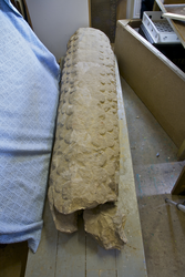
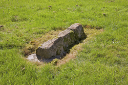
The 16 pieces of the coped gravestone were found in a ditch next to the graveyard at Nisbet. Since then they have been put back together and the grave cover is now in the museum at Wilton Lodge in Hawick.
House
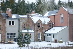
Only part of the head of a cross survives, this the three upper arms carved from greyish-pink sandstone. The earliest known record of the cross is when it was found in the foundations of the house at Appotsyde, about a mile from Hobkirk church. ‘Margaret Trumbill Lady Apotesyde’ is mentioned in possession of the house in 1606 in a dispute. The house was sometime later destroyed and the crosshead taken to Harwood Mill (some distance east of the house) and built into a wall of the byre on the farm there. Later still, it was taken to Harwood House, where it remains. The present house there, which replaced an earlier one, was built in 1835 and has 20thc additions. For many years the cross head was kept outside the door to this house, but sometime between 2002, when Harwood House was sold, and the end of 2017, the cross was reused on the apex of one of the gables of the house; this was carried out when a new roof was installed. Curle (1904) suggested that the cross may originally have been part of a wayside cross and suggested a 12thc date.
Graveyard
In 1606 or 1612 the parishes of Crailing and Nisbet were united and the church at Crailing was appointed to serve both. In 1622 the property and lands which had belonged to the canons of Jedburgh were made into a temporal lordship and given to Sir Andrew Ker. In 1642 Lady Anna Ker, countess of Lothian, was retoured of the tithes of the church of Nisbet and other churches ‘Quae sunt ecclesiae antiquae abbatiae de Jedburgh’. The church at Nisbet was demolished about 1757 and by 1792 there was no vestige left of the building. The churchyard, however, continued in use. In 1905, two coped grave covers were described as being in the churchyard. At that time, it was documented that there were two supports for the tegulated hogback grave cover, one of which was decorated with chevron. This large grave cover had apparently been discovered in 1890 when the churchyard was levelled. In 1944 it was still entire and located at the southern end of the churchyard, but some years later it disappeared and was found broken into 16 pieces lying in a ditch around the churchyard. It has subsequently put back together and is now in the Museum at Hawick. A cross head also existed and was photographed in 1905. The present location of the chevroned stone and cross head is not known.
Farm building
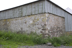
The carved panel is built into an exterior wall of a post-medieval farm building, the farm house next to it thought to be 18thc (but could be early 19thc). Knowetownhead is located near Hassendean Burn, just NW of the site of Hassendean Chapel which was originally located at the juncture of Hassendean Burn and River Teviot. The only other carved stone so far found on the farm buildings is a stone with the date 1828. The last of the lairds of Hassendean seems to be David Scott, who was killed in 1564. Ultimately, the parts were united in the person of Thomas Turnbull, last laird of Minto. In 1673, John Turnbull made a disposition of the land and barony in favour of Walter Scott of Harwood. The land subsequently went through a series of short ownerships but was eventually sold to Gilbert Elliot, who was made first Baron of Minto in 1700. After the church of Hassendean was surpressed in 1690, the parish was split between those of Minto, Roberton and Wilton, the largest part going to Minto. In the land tax rolls for 1803, it states that David Simpson paid £227.8.0 for ‘Know’, but below this, in the same entry, is written that Thomas Gray of Altons paid £214.0.0 for ‘lands now called Knowtownhead’. In the valuation rolls of 1858, ‘Knowtownhead’ is described as ‘a farmhouse with outhouses attached’. At that time, it was inhabited by John Turnbull, though owned by W. J. Scott. John Scott, son of William Scott purchased the estate of Teviotbank about 1804. Teviotbank House was built in 1833, but there had been a previous house called ‘The Knowes’. The farm buildings of Knowetownhead are a short distance from the site of the old church at Hassendean, destroyed by flooding in 1796.
