The Corpus of ROMANESQUE SCULPTURE in Britain & Ireland

Graveyard and site of former church
Graveyard and site of former church
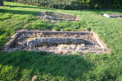
The parish of Lempitlaw, which was at one time a separate parish, was joined with that of Sprouston at an unknown date. The church is now gone, though indents in the ground within the graveyard show its original location. The last vestiges of the church appear to have disappeared by 1845, but it is recorded that shortly before this some ruins were still to be seen. At that time, the parish of Spouston was the property of the Duke of Roxburgh, but the barony of Lempitlaw was the property of the Duke of Buccleuch. A coped, tegulated grave cover survives in the churchyard near the site of the church.
Graveyard and site of former church
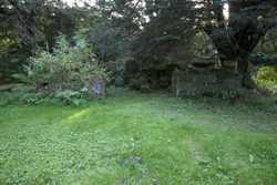
The site of the medieval church is to be found within the grounds of Minto House, which was built for Gllbert Elliot, Lord Minto, c. 1738-43. Repairs of the church at Minto were carried out at various times after the Reformation, with extensive work being undertaken in 1767. At that time, there seems to have been part of a pointed arch surviving. The old parish church at Minto was taken down in 1831, when the parish church moved to a new site. The old site, organised into a small walled cemetary, was incorporated into gardens for Minto house. in 1893, James Robson recorded that a number of carved stones were arranged along the lines of the foundations of the church. By 1983-4, however, the stones left on the site had become overgrown. A team then carried out substantial clearance along with some excavations, and certain records and photographs were made. No stones from a pointed arch were recovered, but a number of grave covers and medieval carved stones were found. Some of the carved stones from the old site have been deposited inside the tower of the present church (see Ruberslaw Church) and others remain on site. Minto House, itself, was demolished in 1992-3.
Graveyard and site of former church
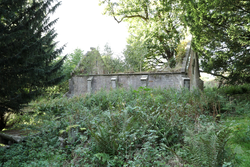
In a graveyard, just south of a derelict mausoleum built in 1830, is a medieval gravestone, its long sides coped and carved with squared imbrication. The mausoleum is believed to be on the same site as an earlier church. This and the surrounding graveyard are sited at Overton in Tulliallan, in a wooded area called Windyhill. A new parish church was built on a different site in 1675-6, but this church, now called the ‘old church’, is itself a ruin and the present parish church, built in the the 19th century, is located in yet a different location. The Statiscal Account of 1794 described the early church at Windyhill as “very small, being only 36 feet in length, 16 in breadth, and 8 feet in height.” Between 1889 and 1892, the parish of Tulliallan was transferred from a detached part of the county of Perth to that of Fife, in which it remains.
Graveyard and site of former church
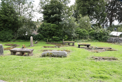
Only the old churchyard now survives, within which is a coped grave cover thought to date from the 12th century. Another medieval coped grave cover also exits within the same churchyard, but it is believed to date from a later period. A new parish church for Tillicoultry was built on a different site in 1773. Following this, the old church was taken down, though no specific record of this has been found and the exact site of the church is uncertain. The old churchyard is sited immediately SE of the former Tillicoultry House, built in the early 19th century and demolished about 1960. After 1644, ownership of the Tillicoultry estate changed hands several times. In 1814 it came into the hands of Wardlaw Ramsay family. Ultimately, the area was built up with new housing, leaving the old churchyard as an isolated patch of land.


