The Corpus of ROMANESQUE SCULPTURE in Britain & Ireland

Parish church
Parish church
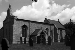
Cranwell is a village in the North Kesteven district of the county, 3 mile NW of Sleaford and 11 miles NE of Grantham. The church stands on the main road through the village and is a small, odd-looking church having a low nave with a flat roof , a N aisle and a S porch, and a tall chancel with a pitched roof. There is no tower but a 17thc bellcote topped by an obelisk finial on the W gable. There is evidence of an 11thc nave to which a 3-bay N arcade was added, and this was later extended to the W by one bay in the 13thc. The chancel arch is 13thc, but the chancel itself is Perpendicular. The N aisle wall was rebuilt in 1812 and whole church was largely rebuilt in a 1903-4 restoration by C. H. Fowler.
Construction is of coarse limestone rubble and ashlar, with ashlar dressings.
Parish church
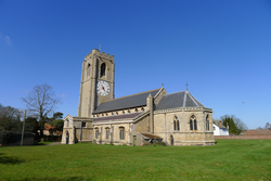
Coningsby is a small town in the East Lindsey district of the county, 10 miles NW of Boston and 17 miles SE of Lincoln. The church stands on the High Street, and has a W tower, an aisled nave with a S porch, and a polygonal apse rebuilt in 1870. The tower is 14thc with a 15thc embattled parapet; the nave arcades are 13thc work and none of the fabric appears earlier than this. Romanesque sculpture is found on an inverted capital now used as a step for the 14thc font.
Parish church
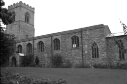
Scotter is a large village in the West Linsey district of the county, 19 miles N of Lincoln and 25 miles W of the coast at Grimsby. The church is to the E of the village centre and consists of a Perpendicular W tower, a nave with a late 13thc. four-bay N aisle, 15thc. clerestory, and S porch built in 1820. There was a major restoration between 1947-50. The S doorway into the nave is the only Romanesque feature.
Parish church
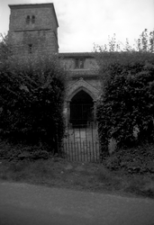
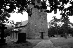
Kingerby is a village in the West Lindsey district, 5 miles NW of Market Rasen. In this quiet, remote hamlet, the church solemnly stands hidden by its sylvan surroundings. It is constructed of squared and coursed ironstone rubble, and is primarily of the 13thc. and consists of a W tower, nave with clerestory, S aisle, S porch and chancel. The former N aisle has been demolished but the 13thc arcade is still visible. The W tower may be 11thc on the evidnce of a small circular window, now inside the church. The nave roof was replaced in 17thc., and the chancel roof in the 19thc. The church was declared redundant in 1980 and is now under the care of the Churches Conservation Trust.
Parish church
Great Moulton is a vilage in Norfolk, located about 10 miles SSW of Norwich. The church of St Michael was rebuilt in 1887 but the Romanesque tower arch and imposts survive, as does the coursed flint masonry of the chancel and nave, bearing traces of round-headed windows. The fragment of a decorated colonnette is the only Romanesque sculpture observed at the site. It may have come from a window, as with the similar example in situ at St Mary Magdalene, just outside the centre of Cambridge.
Parish church
The parish of Moorlinch, which is on the southern slopes of the Polden ridge, lies 6 miles E of Bridgwater. Most of the land lies on Keuper marl, with irregular areas of clay and limestone on the higher slopes, and alluvium between the marl and the peat of Sedgemoor. The church of St Mary, which is in a prominent position and dates from the 13thc., consists of a nave with S porch, chancel and W tower. The outer doorway contains restored Romanesque work. The tub font is also perhaps Romanesque work.
Parish church
The small town of Portishead occupies a strategic position on the S side of the mouth of the river Avon, and once enjoyed a trading importance subsidiary to Bristol, 8 mi away to the East. Now in North Somerset, Portishead was part of the County of Avon between 1974 and 1996. The town church of St Peter is in a surprisingly quiet area, surrounded by an airy rural atmosphere: no wonder local people refer to it as the ‘village’. The church has Romanesque origins but was rebuilt in the 14thc and 15thc in Perpendicular style. It was altered and extended to the east in 1878-9 using old materials and features. The font is Romanesque; there is also a possible early altar slab.
Parish church
The manorial hamlet of Laverton lies in rich farmland 8.5 miles S of Bath, about halfway between Frome and Norton St Philip. It is in a dip: the N-facing side is a valley of the Hennambridge Brook, a tributary of the river Frome. The manor house (now belonging to the Duchy of Cornwall) and church of St Mary are adjacent. The church, which is built of rubble, consists of an unusual W end, which Pevsner finds to be reminiscent of a westwerk (described as a tower in the HE listing), nave, N porch, chancel and vestry. It is mostly of the 11thc, with 15thc alterations. There was a restoration in 1859. The Romanesque elements consist of N (and possibly S) nave doorways and two windows in the western section.
Parish church
Rothwell is a small village in the West Lindsey district of Lincolnshire, 9 miles N of Market Rasen and 2.5 miles SE of Caistor. The church is reached by a narrow path leading off School Lane, which runs S from the village centre. It has a late-11thc W tower of coursed rubble, a nave with 3-bay aisles added in the mid-12thc, and a chancel, which was restored in 1892 by J. D. Sedding.
Parish church
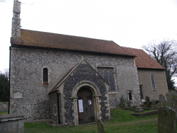
Walmer is a coastal town 6 miles SE of Sandwich and just over 7 miles NE of Dover. The church of St Mary has a twin-cell form with a tall nave and chancel, and a later porch. A N aisle was added in the 17thc and demolished in 1898, returning the building - the 'unsightly object' seen by Glynne in the mid-19thc - back to its original size. A new church dedicated to St Mary was built nearby in the late 19thc, after which the original church became known a 'Old St Mary's' or St Mary the Blessed Virgin. Features of interest include the chancel arch and the S doorway.
